Released by Mayor Ronald Morrell Jr. · Released by Mayor Morrell, August 23, 2026 · page 1
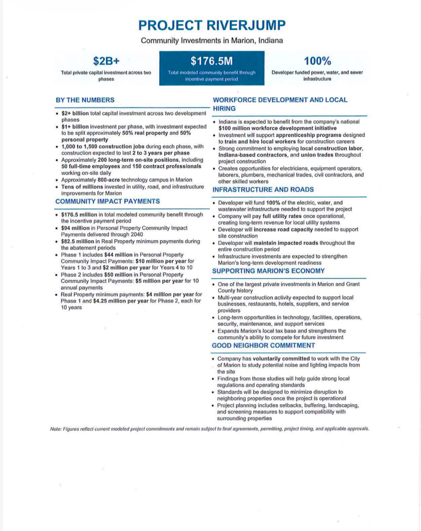
“Approximately 800-acre technology campus in Marion”
The one-page summary as Marion's mayor published it, saying the deal had become real and the details belonged to the public. It never says "data center," never names the company, and never says where in Marion.
Page 1. ourweek.in/records/data-centers/riverjump-mayor.pdf
On August 23, 2026, Mayor Ronald Morrell Jr. published this sheet on his public Facebook page, with a statement saying the deal had become real and that he had promised the details would be made public when it did. It describes $2 billion of private investment across two phases, an approximately 800-acre technology campus in Marion, and $176.5 million in what it calls "total modeled community benefit through incentive payment period" — $94 million of that in personal property community impact payments, $82.5 million in minimum real property payments. The sheet says its figures are modeled and remain subject to final agreements, permitting, project timing and approvals.
It never uses the words "data center." It never names a company. It never says where in Marion.
OurWeek obtained the same sheet in August, before it was public. The mayor's copy matches ours figure for figure. Tap it to read it full screen. The whole report is also a PDF to print or hand out, with every recording carried as a QR code that opens the video at the moment quoted.
For a year Grant County argued about a data center while county officials said, on the record, that they knew of no site anybody had proposed. The mayor's statement is the first we have found from anyone in government that a project is real — and it is about ground inside Marion, which the county's moratorium does not reach. There is still no application on file, and no company has been named in any government document as the one behind the Marion project. On August 26 the mayor issued a second statement: he will not endorse the proposal — describing it, in his own words, as "a hyperscale data center in West Marion." And in interviews the Chronicle-Tribune published on August 27, he named the company: updates about the project, he said, "should come directly from Meta or its representatives."
And there is a study the commissioners paid for that told them to soft-pedal the subject in all public documents and secure land options before any public announcement.
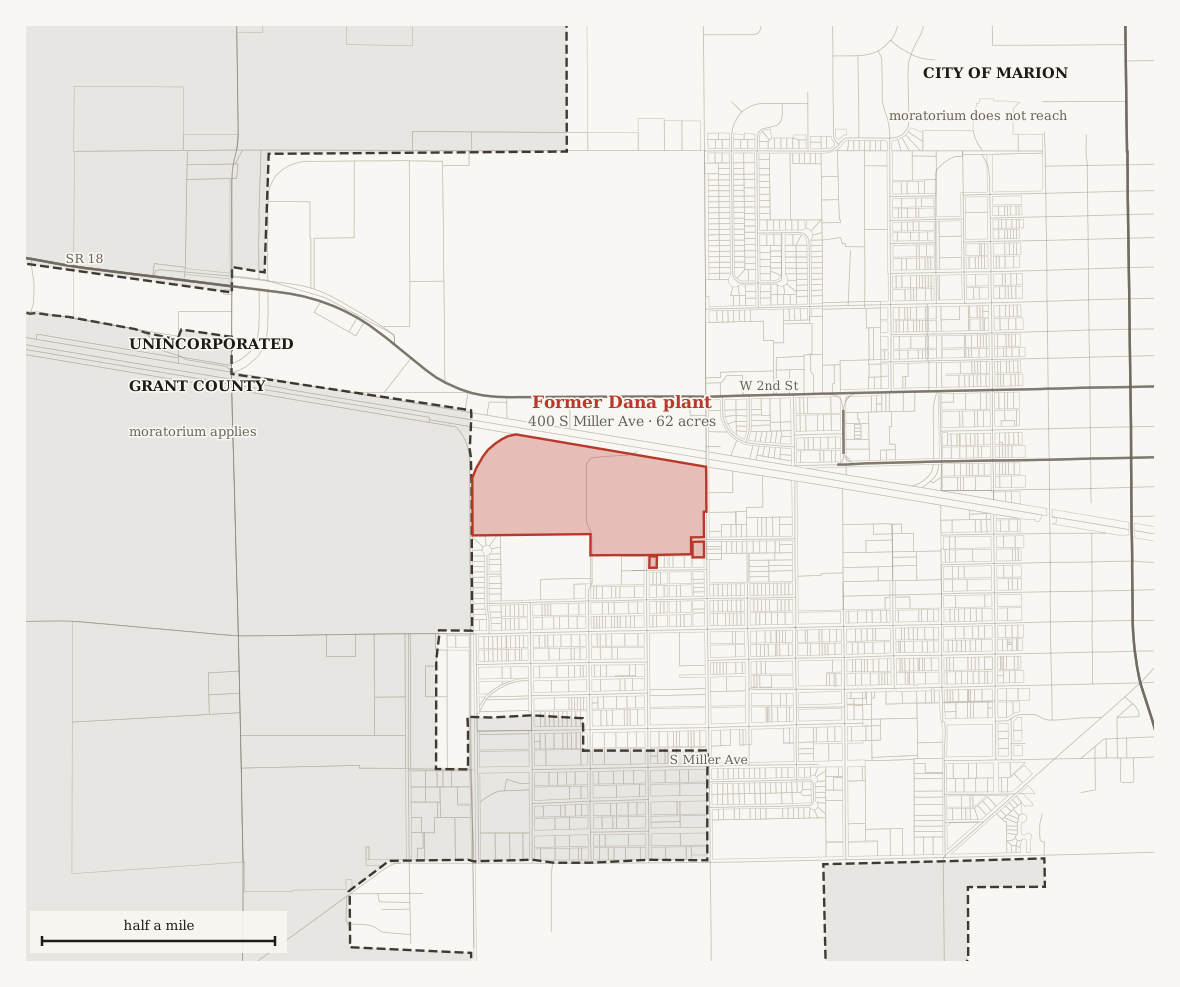
The talk around town has a location: the old Dana plant on Marion's west side. A resident told the county plan commission in March 2026 that she had heard it rumored for two years. The county's feasibility study is about somewhere else — the I-69 and State Road 26 interchange at Exit 255, southeast of the city, which is where the study was focused, and inside the unincorporated county the moratorium covers. Nothing we have found puts a data center at Dana: no application, no land transfer, no county document. Mayor Morrell says the project is real, and three days later said he will not endorse it. His second statement calls it a hyperscale data center in West Marion; his interviews name Meta; no statement names a parcel. Dana is still not confirmed. That gap is the story.
What follows is the play by play of how Grant County got here, built from 20 recorded meetings, a full-text search of every set of Grant County minutes back to 1997, and the ownership and transfer records of 1,753 parcels. Everything below is tied to a document, a recording, or named outside reporting. Tap any moment to open it — the recording plays where the words were said, or the page opens with the relevant text highlighted. Where the evidence requires an inference, or where the talk around the county runs past the record, that is said plainly.
What we found
How to read this. Every claim on this page is filed in one of three states — confirmed by the record, contradicted by the public record, or unconfirmed and not ruled out. They are collected in one place further down, under "Common claims, and where each one stands." Where a conclusion is our reading of the documents rather than something a document says outright, the text says so.
Dana. The old plant on Marion's west side is what the talk names. A resident told the county plan commission in March 2026 that she had heard it rumored for two years. No application, land transfer or county document places a data center there.
Marion. A one-page summary describing $2 billion of investment and a roughly 800-acre technology campus reached OurWeek in August 2026. On August 23 Mayor Morrell published the same sheet himself and said the deal had become real. It still never says "data center," never names a company, and never says where in Marion. On August 26 the mayor said he will not endorse the proposal — and called it, for the first time, a hyperscale data center in West Marion. In interviews published by the Chronicle-Tribune on August 27, he named Meta as the company to answer for the project, said no deal had been presented to the city council, and went past the non-endorsement: no data center development in Marion under his administration.
The county. The commissioners paid for a feasibility study of the Exit 255 interchange. It has a section headed "The Data Center Dilemma," and it recommends soft-pedaling the idea in all public documents and securing land options before any public announcement.
The land. We checked 1,753 parcels and 1,255 owner names across the three areas in question. No completed assembly is visible in those records, and no county officeholder appears as an owner. Options — the exclusive right, but not the obligation, to buy later, which is what the study recommends — transfer no title, and so would not appear in them at all. On August 23 Mayor Morrell said owners have already agreed to sell.
The moratorium. The county's moratorium covers unincorporated Grant County. It does not reach inside Marion, which is where the talk points. And it is not a fixed two years: the ordinance ends it on March 16, 2028 or when the county adopts a zoning amendment governing data centers, whichever comes first. The plan commission's data center subcommittee has been drafting that amendment since March 2026. A moratorium is a pause while rules are written; when the rules exist, the pause ends and the rules govern.
Here is how it happened.
It starts with a closed factory
Before the study, before the moratorium, before the mayor's announcement, the commissioners pull two parcels out of the county tax sale so they can decide themselves what becomes of them.
Grant County Commissioners · December 19, 2022 · page 4 · at 1:13:12
“work with some of our locals to see if that property can be put to better use”
400 South Miller Avenue in Marion — the old Dana plant.
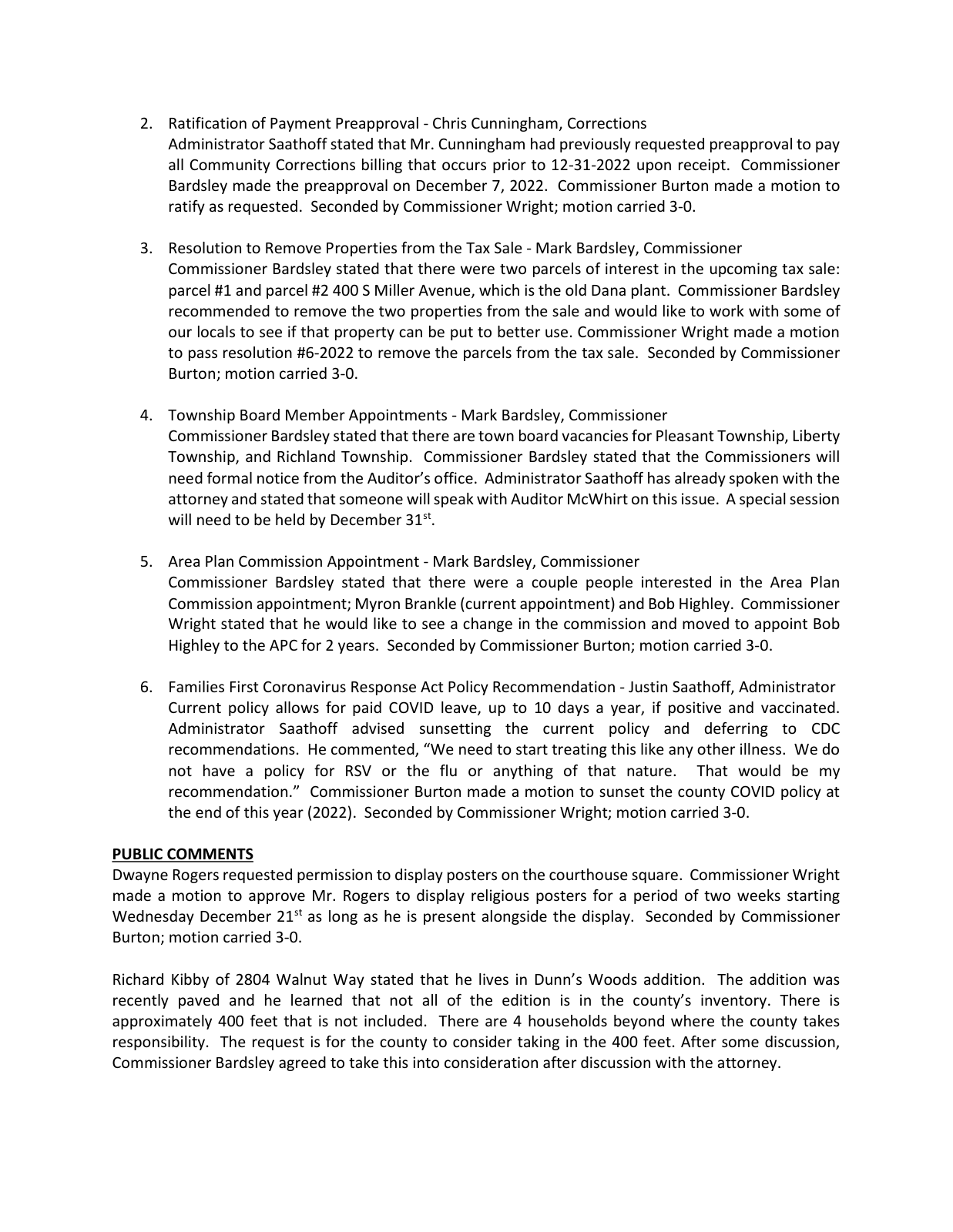
Page 4, the boxed lines. ourweek.in/records/data-centers/dana-tax-sale.pdf
Scan to hear it said
Grant County Commissioners, December 19, 2022, at 1:13:04
https://youtu.be/q41WXKa2U54?t=4384
That is the county doing the ordinary work of local government: taking on hard industrial ground and looking for a use for it. It happens in open session in December 2022, and nobody objects.
The next spring somebody asks for a place on the agenda, having heard about it.
Grant County Commissioners · May 1, 2023 · page 3 · at 56:10
“I heard you guys got Dana”
Darren Reese, of the Indianapolis environmental firm SESCO, under the agenda heading "Discussion of Economic Growth Opportunity."
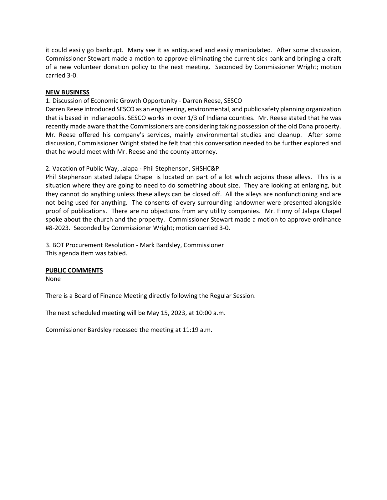
Page 3, the boxed lines. ourweek.in/records/data-centers/reese-2023-economic-growth.pdf
Scan to hear it said
Grant County Commissioners, May 1, 2023, at 56:04
https://youtu.be/k-oqgldJcx4?t=3364
Grant County Commissioners · August 7, 2023 · page 3
“Darren Reese presented the environmental solutions proposal for the old Dana property to the board.”
In August the commissioners sign — $13,446, in two phases, to find out what is in the ground.
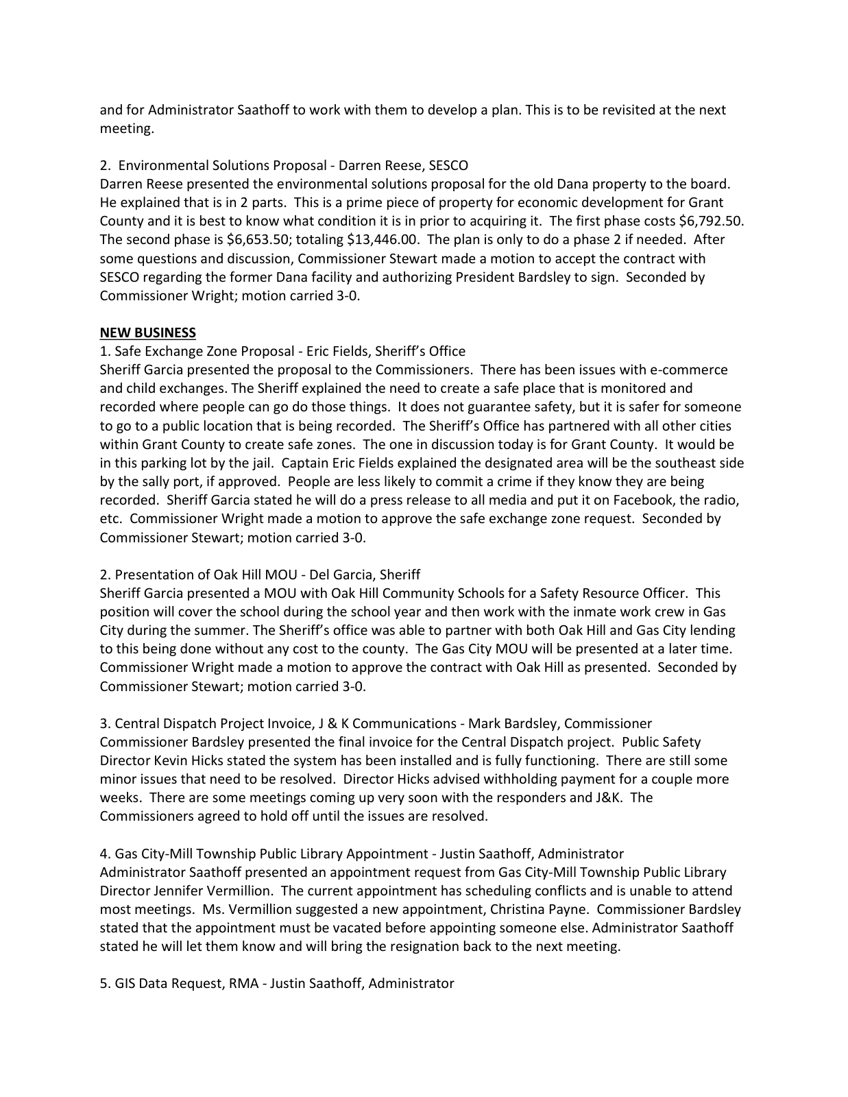
Page 3, the boxed line. ourweek.in/records/data-centers/reese-dana-contract.pdf
Reese sits on Marion's redevelopment commission as well, which makes his appearance before the county commissioners notable. Nothing in any public record we can search connects him or his firm to a data center: not the county's minutes back to 1997, not any meeting recording since 2020, and not Marion's own redevelopment minutes — all fifty-nine documents in that archive, 2017 through this July.
The machinery starts in earnest in March 2025. A consultant introduces himself.
Grant County Commissioners · March 17, 2025 · page 4 · at 1:17:19
“Mr. Bookout presented a draft proposal for economic development in Grant County. This is a 90-day trial and has a 30 day exit clause. The start date is April 1, 2025.”
The consultant introduces himself and his firm, and the county puts him under contract on a 90-day trial.
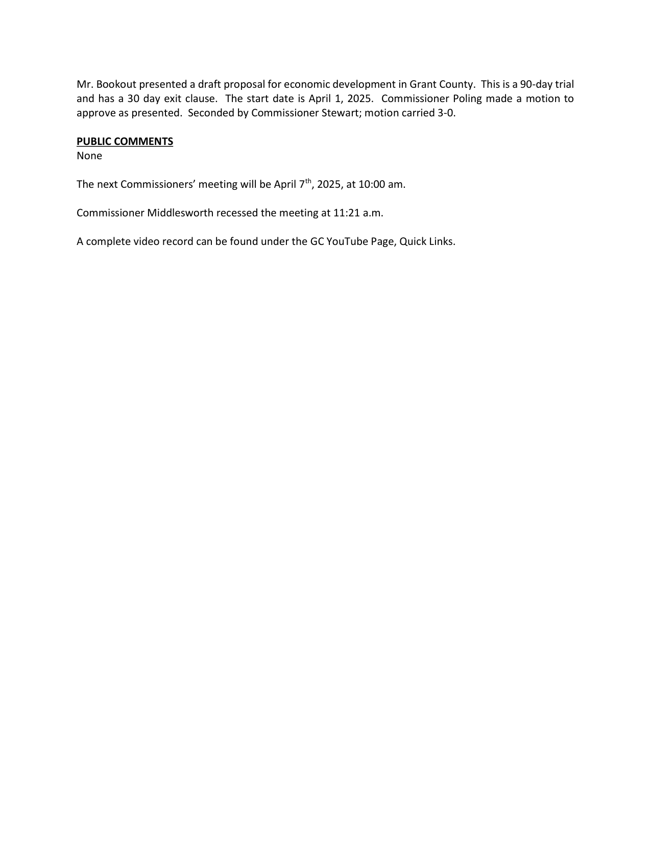
Page 4, the boxed lines. ourweek.in/records/data-centers/bookout-first-pitch.pdf
Scan to hear it said
Grant County Commissioners, March 17, 2025, at 1:17:11
https://youtu.be/6L3bAaAkIhI?t=4631
Brad Bookout's firm, Augusta Consulting, goes under contract on a ninety-day trial with a thirty-day exit. That is the arrangement that will still be running the county's development work eleven months later.
A body is built, and it has no money
In May the commissioners create a county redevelopment commission.
Grant County Commissioners · May 19, 2025 · page 3 · at 42:00
“Redevelopment Commission Ordinance-Martin Harker, Attorney-Attorney Martin Harker explained the ordinance.”
Two months later the county creates a redevelopment commission.
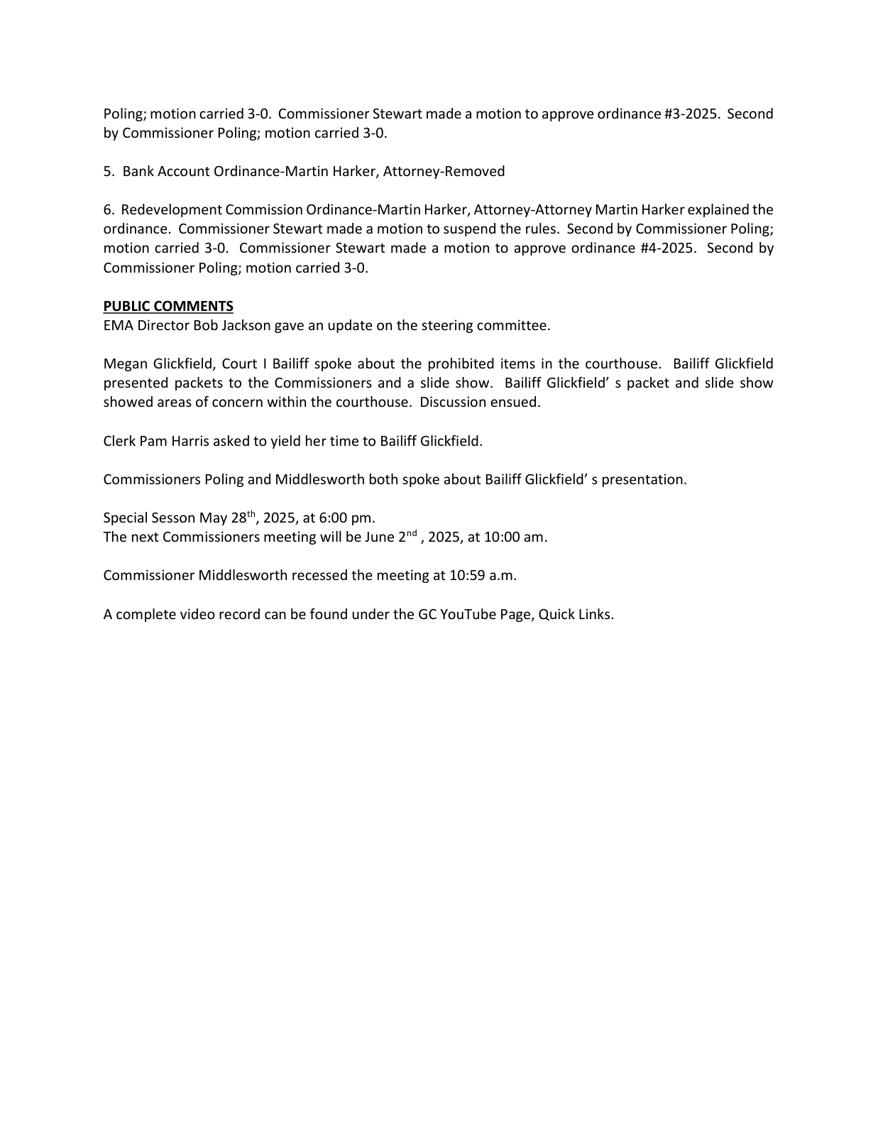
Page 3, the boxed lines. ourweek.in/records/data-centers/rdc-created.pdf
Scan to hear it said
Grant County Commissioners, May 19, 2025, at 41:52
https://youtu.be/R54p21sCwCg?t=2512
In July it organizes. A sitting county commissioner takes the chair, and the first thing the new body does with its authority is hand the meeting back to the consultant.
Grant County Redevelopment Commission · July 7, 2025 · at 3:52
“officially we have myself as president, vice president is Victoria Herring, secretary is Mark Leming. At this time I'll let Mr. Bookout take over.”
Officers elected, the new commission's first act is to hand the meeting to Brad Bookout of Augusta Consulting, the private firm the county contracts as its economic development office. He has already led the prayer. He then volunteers to write the minutes.
Scan to hear it said
Grant County Redevelopment Commission, July 7, 2025, at 3:42
https://youtu.be/JSJQh6BAXys?t=222
Later in the same meeting the consultant proposes a title for himself, and gets it.
Grant County Redevelopment Commission · July 7, 2025 · at 8:28
“included with that work is the ability for our staff to serve as the temporary director of this body. There's no additional costs needed at this time”
Later in the same meeting, Bookout proposes himself as the commission's director. Mark Leming moves it, Frank Hicks seconds, it carries. The county attorney is explicit that the title creates no employment: he stays an independent contractor.
Scan to hear it said
Grant County Redevelopment Commission, July 7, 2025, at 8:22
https://youtu.be/JSJQh6BAXys?t=502
Asked what a director can actually do, he answers plainly.
Grant County Redevelopment Commission · July 7, 2025 · at 11:01
“if you desire in a meeting for me to go meet with a property owner, I go and meet with the property owner, relay information back to you”
Asked from the floor what authority a director has, he says he cannot decide anything on the body's behalf, and describes what he does instead.
Scan to hear it said
Grant County Redevelopment Commission, July 7, 2025, at 10:53
https://youtu.be/JSJQh6BAXys?t=653
Asked where the money for all this comes from, the answer is that there isn't any.
Grant County Redevelopment Commission · July 7, 2025 · at 13:45
“this body has no money. There is no money for services for what the work that will be taking place”
The consultant is paid a flat monthly fee out of the commissioners' own budget line, not by this body.
Scan to hear it said
Grant County Redevelopment Commission, July 7, 2025, at 13:37
https://youtu.be/JSJQh6BAXys?t=817
By August the commission is talking about drawing Tax Increment Financing (TIF) districts across every unincorporated industrial and commercial parcel in the county — before anyone asks for one.
A TIF district freezes the assessed value of the ground inside it at a base year. Tax on that frozen base keeps flowing where it always went — the schools, the library, the township, the county's general fund. Everything above it, the increment new development creates, is generally captured for the redevelopment commission instead, to spend on infrastructure inside the district or to retire the debt it issued to build that infrastructure. For allocation areas established after June 30, 2008, Indiana generally limits the allocation period to twenty-five years from the first TIF-backed obligation, with statutory exceptions.
Nothing about drawing one requires a company, a project or a name. A commission can put a district over empty farm ground and wait.
The reason its director gives is on the recording.
Grant County Redevelopment Commission · August 4, 2025 · at 23:44
“rather than just haphazardly have some entity show up and say boom, this is what we're going to do at this interchange and surprise everybody”
Brad Bookout, the commission's director, arguing for economic development areas across the unincorporated county before anyone arrives. He prefaces it seconds earlier: "There's not a specific project... not raising red flags that there's something coming, because that is not the case."
Scan to hear it said
Grant County Redevelopment Commission, August 4, 2025, at 23:30
https://youtu.be/qg14AIrKJJ0?t=1410
In August 2025, the county's redevelopment commission is being told to map the ground at Exit 255 so that they are not surprised by an entity showing up to build there — by its director, who is a paid consultant from Muncie and not a member of the body he directs. Nothing in the public record shows that anyone had told them a company was coming.
Moments earlier, the commission's president — Shane Middlesworth, who is also a sitting county commissioner — had said something else.
Grant County Redevelopment Commission · August 4, 2025 · at 23:20
“pretty promising if you could get major development to help pay for utilities and sewer and water. I mean, it'd be huge. I know there's some interest already.”
Shane Middlesworth — county commissioner, and president of this commission — on the interchange study, seven weeks before it is dated. Whose interest, or interest in what, he does not say, and nothing in the record settles it.
Scan to hear it said
Grant County Redevelopment Commission, August 4, 2025, at 23:03
https://youtu.be/qg14AIrKJJ0?t=1383
Then the director, seconds later: there is no specific project, and he is not raising a red flag that something is coming. Then: plan it, so nobody shows up and surprises everybody. Three statements inside a minute, in that order, from the two men running the meeting. What the interest was in, or whose it was, neither of them says, and no document we have found settles it.
A month later the maps arrive.
Grant County Redevelopment Commission · September 2, 2025 · at 4:35
“at the last meeting you all had recommended that I prepare maps”
Bookout brings the maps he was asked for. That same morning the commissioners had put Baker Tilly and Barnes & Thornburg under contract to serve this body, and its new financial adviser, Greg Balsano, is at the table telling them a TIF base year has to be set before the development comes, not after.
Scan to hear it said
Grant County Redevelopment Commission, September 2, 2025, at 4:25
https://youtu.be/iFVYi0jMeyk?t=265
The commissioners had spent that same morning putting a financial adviser and a bond counsel under contract for a body with no money of its own. Then somebody at the table asks the question the whole exercise invites.
Grant County Redevelopment Commission · September 2, 2025 · at 9:51
“Isn't that putting the cart before the horse? We're doing this with no… we don't have anybody saying we want to.”
From the table, as Baker Tilly's adviser finishes explaining the first step. The answer he gets: "I think it's a fair question."
Scan to hear it said
Grant County Redevelopment Commission, September 2, 2025, at 9:37
https://youtu.be/iFVYi0jMeyk?t=577
Later in the same meeting comes the plainest description anyone in this story gives of how a company actually arrives.
Grant County Redevelopment Commission · September 2, 2025 · at 24:42
“they're doing it discreetly because they don't want the word to get out that a big company's coming… what they're going to get to is what we all got to — looking for those mustard yellow properties and then approaching those land owners”
Brad Bookout, describing how a company arrives in a county. He had defined the color himself twenty minutes earlier, presenting the maps: "the parcels in mustard yellow are of course industrial zone parcels in unincorporated Grant County for consideration."
Scan to hear it said
Grant County Redevelopment Commission, September 2, 2025, at 24:30
https://youtu.be/iFVYi0jMeyk?t=1470
In October the discussion becomes a calendar. EDA is the county's shorthand for an economic development area — the boundary a redevelopment commission draws to make ground eligible for its powers, and which, unlike the older redevelopment areas, requires no finding that the ground is blighted. The TIF district is the tax capture inside that boundary. First on the timetable is the I-69 and State Road 26 interchange.
Grant County Redevelopment Commission · October 6, 2025 · at 1:37
“the draft of the EDA TIFF timetables and maps”
October 6. The study naming Exit 255 is finished and dated. It will not be read to the commissioners in open session for another two weeks.
Scan to hear it said
Grant County Redevelopment Commission, October 6, 2025, at 1:31
https://youtu.be/opObQKYjQiU?t=91
On December 1 the commission votes. Bond counsel walks them through a four-step process — this body, then the plan commission, then the county commissioners, then a public hearing — and explains why the calendar matters.
Grant County Redevelopment Commission · December 1, 2025 · at 12:59
“because we're adopting this resolution here at the end of 2025, your base assessment date will be January 1st, 2025, even though we likely will not get through the four-step process until the beginning of 2026”
Dustin Meeks of Barnes & Thornburg, on why the date of the vote matters. The plan itself, he says a minute earlier, is "intentionally broad… almost as broad as the statute allows," to give "flexibility as you look at sites in this area."
Scan to hear it said
Grant County Redevelopment Commission, December 1, 2025, at 12:51
https://youtu.be/GOUVfr_ZMi4?t=771
An earlier base year freezes the ground at a lower value. For as long as the district runs, the schools, the library, the township and the county's general fund go on taxing it at that base — which annual neutralization adjusts for reassessment, but which does not rise with what gets built. Tax on the value above it is generally captured for the redevelopment commission instead, though Indiana lets a commission release excess incremental value back to the other units, and some do. So the earlier the base date, the more of whatever gets built there can become increment.
Voting in December 2025 rather than early 2026 fixes the base at the January 1, 2025 value: a full year earlier.
The order also cannot be reversed. A district drawn after a building is already assessed cannot capture that value, because it is already in the base; only growth above the base becomes increment. Draw it first, and new assessed value there can become increment for the life of the district.
Then a second resolution, for a second area. We found no earlier public request for it in the records we searched.
Grant County Redevelopment Commission · December 1, 2025 · at 15:39
“provides a map for the westside economic development area, which is just to the west of the city of Marion and in between the city of Marion and the town of Sweetser”
Declaratory resolution 002-2025. The second of two economic development areas taken up that afternoon, and the one for which we found no earlier public request in the records we searched.
Scan to hear it said
Grant County Redevelopment Commission, December 1, 2025, at 15:31
https://youtu.be/GOUVfr_ZMi4?t=931
That is the ground between Marion and Sweetser, on the city's western edge. Asked how those boundaries were arrived at, the room is told.
Grant County Redevelopment Commission · December 1, 2025 · at 17:11
“Commissioner Middlesworth worked cooperatively with the mayor to identify areas that were most agreeable for the county to establish the EDA on the west side in”
Asked about the west side boundaries, the answer from the table names who drew them.
Scan to hear it said
Grant County Redevelopment Commission, December 1, 2025, at 17:05
https://youtu.be/GOUVfr_ZMi4?t=1025
Eighteen days before the study lands, the county adopts its comprehensive plan. Page 94 records what people told it they wanted.
Grant County · September 2, 2025 · page 94
“More than 75% of first public meeting attendees believe agricultural land should be preserved from large-scale development.”
Adopted eighteen days before the study was delivered.
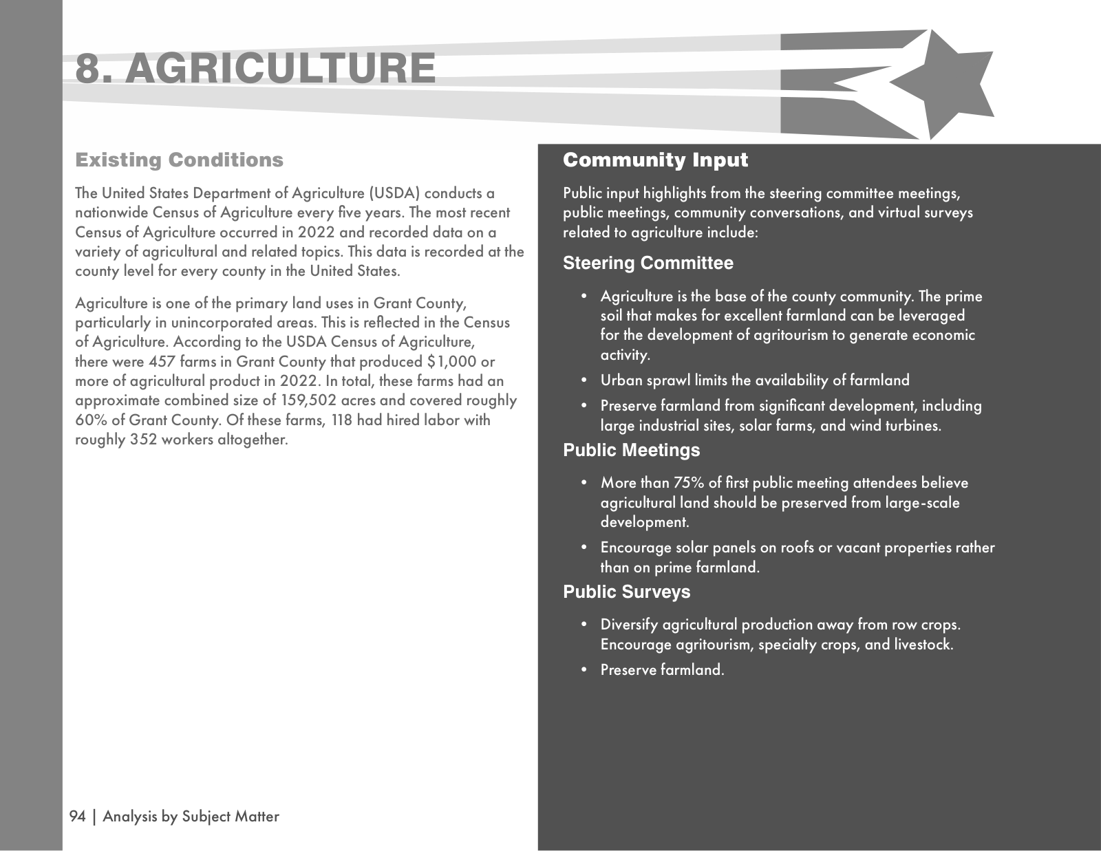
Page 94, the boxed lines. https://secure.in.gov/counties/grant/files/Grantco_CompPlan_9.02.25.pdf
The study
The Exit 255 Economic Development Feasibility Study is dated September 20, 2025. BCS Management had been engaged by the commissioners that April, and its author would read the finished report to them in October. It has a section headed "The Data Center Dilemma." The recommendation it makes there is that the county soft-pedal the data center idea in all public documents and — "most critically," in the study's words — proactively secure options on land parcels before any public announcement.
BCS Management, for the Grant County Commissioners · September 20, 2025 · page 26
“The county must "soft-pedal" the data center idea in all public documents and, most critically, proactively secure options on land parcels before any public announcement to prevent landowners from driving up property prices.”
The recommendation, in the study's summary of findings.
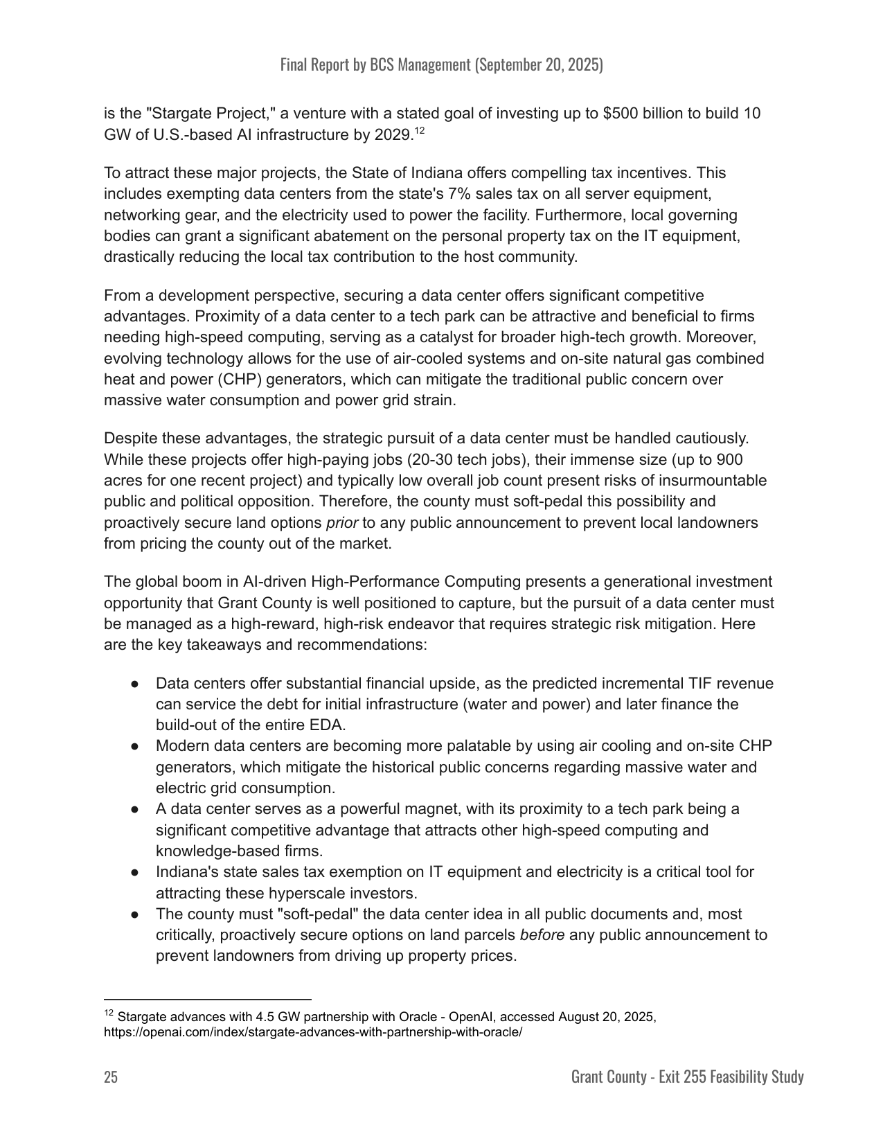
Page 26, the boxed lines. ourweek.in/records/data-centers/exit255-study.pdf
BCS Management, for the Grant County Commissioners · September 20, 2025 · page 26
“Therefore, the county must soft-pedal this possibility and proactively secure land options prior to any public announcement to prevent local landowners from pricing the county out of the market.”
And again in the body of the same page.
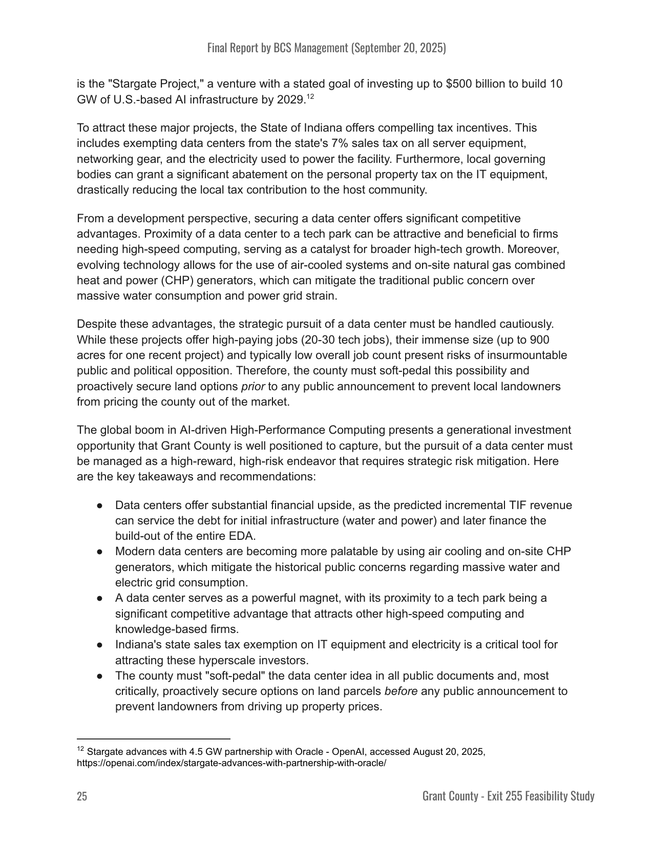
Page 26, the boxed lines. ourweek.in/records/data-centers/exit255-study.pdf
A county-commissioned document, recommending that the county say less and move first, and giving its reason in the same sentence: to prevent local landowners from pricing the county out of the market.
It is also the method the county's own development director had described to the redevelopment commission eighteen days before the study is dated: the quiet approach, the zoning map, the landowners. He was not describing what the county would do. He was describing what a company does, and saying it is what they had all arrived at.
There is a case for that advice, and the study makes it in the same breath: an owner who learns a public body needs his ground can price accordingly, and an assembly that needs forty parcels can be stopped by the fortieth. Confidential land assembly is common in large economic development projects for that reason. Site selectors commonly require confidentiality as a condition of looking at a place at all, and a county that announces first and buys second generally pays more. On that reading the recommendation is not secrecy; it is the ordinary practice of the trade, written down.
What the record does not settle is the other half of it — where that practice ends. At what point does a public body mapping ground, drawing tax districts, weighing infrastructure spending and considering tax abatements owe the people who live there an account of what it is doing?
What happened when it was presented
On October 20 the study's author presents the final report to the commissioners in open session. He tells them he will read his comments to keep it brief, and then take questions. The prepared remarks run about nine minutes; the whole item is over in thirteen.
The words "data center" are never said.
Grant County Commissioners · October 20, 2025 · page 2 · at 20:56
“BCS Management-Final Report-Chris from BCS Management read and explained the final report and gave recommendations.”
The study is read to the commissioners in open session. Across seventy-five minutes the words data center are never said; the closest the presentation comes is a very high capacity large user.
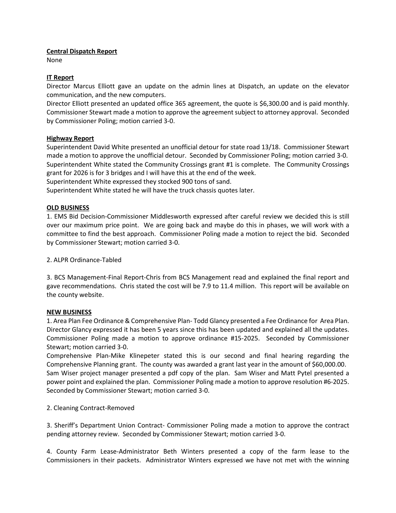
Page 2, the boxed lines. ourweek.in/records/data-centers/kellner-presents.pdf
Scan to hear it said
Grant County Commissioners, October 20, 2025, at 20:44
https://youtu.be/M4REf1sdInw?t=1244
That is not an accusation. It is a count. We reviewed the entire recording — the full seventy-five minute meeting, not only his item: "data center" does not occur, and neither does "hyperscale." The study contains both — its utilities section cites the local utility's forecast that hyperscale data centers need "over 500 MW of capacity," and that by 2030 they will be about sixty percent of that utility's peak load across Indiana.
Electricity did come up. The substations near the interchange have seven to eight megawatts to spare, the author said, which is "a lot for homes or for typical commercial developments" and short only for "a very high capacity large user, say a typical one over 10 megawatts." That is the threshold for needing a new substation at this interchange. Ten megawatts is data center scale — but it is far below the hyperscale developments discussed elsewhere in the same study, whose figure for the projects driving that utility's projected load growth is over five hundred megawatts.
The community reads it for itself
Three weeks after the commission drew that second area, a joke about it appeared. On December 21, 2025 a Wabash County satire page published a mock news story announcing a data center "constructed west of Marion along Highway 18," built to store footage from the license plate cameras that had been going up around the county. The target of the joke is surveillance. The location is scenery.
Highway 18 west of Marion runs through the boundary proposed for the west side economic development area. Three quarters of the parcels in that ground lie within half a mile of that road, and ninety-nine percent within a mile; the nearest other state route, State Road 13, is about three miles off. Nothing suggests the writer knew what the commission had done three weeks earlier, and this page does not suggest it. What can be said is the order of events: the county proposed a development boundary over the corridor, and then a joke put a data center in it.
Several of the things the piece played for laughs — the cooling, the water, the noise, what happens to the building when it is abandoned — are what the county's own subcommittee would spend 2026 writing rules about.
The study was public too. Over that winter people read it, and by March 2, 2026 they were saying so from the podium.
Grant County Commissioners · March 2, 2026 · at 1:12:48
“data centers were mentioned in Chris's study that he did on I69 State Road 26”
"I'm sure because of that information was in there that has created some alarm."
Scan to hear it said
Grant County Commissioners, March 2, 2026, at 1:12:38
https://youtu.be/Nx2IEEhOWYc?t=4358
One of them asks the plainest question available, and gets a plain answer.
Grant County Commissioners · March 2, 2026 · at 1:04:02
“If I may publicly ask, who actually paid for that study? I don't know who actually paid for that study from BCS management.”
A resident, in public comment, four months after the study was read to the board. The answer comes back at once: "the commissioners paid for that study, ma'am."
Scan to hear it said
Grant County Commissioners, March 2, 2026, at 1:03:56
https://youtu.be/Nx2IEEhOWYc?t=3836
He keeps going, into what the study was for.
Grant County Commissioners · March 2, 2026 · at 1:04:40
“All we're trying to do — not data centers — is to see if we want development out on 69 and 26, whether that's restaurants, truck stops, hotels, whatever that is.”
"No doubt not data centers but a business park."
Scan to hear it said
Grant County Commissioners, March 2, 2026, at 1:04:30
https://youtu.be/Nx2IEEhOWYc?t=3870
That description is in the study. Printed page 26 is headed "Insight from Augusta Consulting": it records that interest in a Buc-ee's has been expressed and weighs which corners of the interchange would suit one, and it describes demand for divisible warehouse, light manufacturing and small business space of 15,000 to 30,000 square feet.
BCS Management, for the Grant County Commissioners · September 20, 2025 · page 27
“Electricity under 1 MW with three-phase power”
The buildings that page specs, and the power they need.
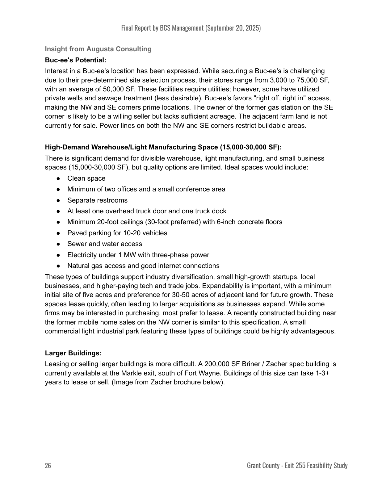
Page 27, the boxed line. ourweek.in/records/data-centers/exit255-study.pdf
The other description is in the same document, on the two pages before it. "The Data Center Dilemma" runs across printed pages 24 and 25, and it ends in the recommendation to soft-pedal the idea and secure land options first.
Both accounts of the study are accurate. They are consecutive pages of it.
The buildings on page 26 are specced at under one megawatt. Elsewhere in the same study, the hyperscale developments driving that utility's projected load growth are put at over five hundred.
Then, that same morning, a commissioner moved to shut the door.
Grant County Commissioners · March 2, 2026 · page 3 · at 53:12
“I would like to recommend we do a 24-month moratorium on any data center coming to Grant County in an unincorporated area.”
Ron Stewart moves a 24-month moratorium; Shane Middlesworth seconds it.
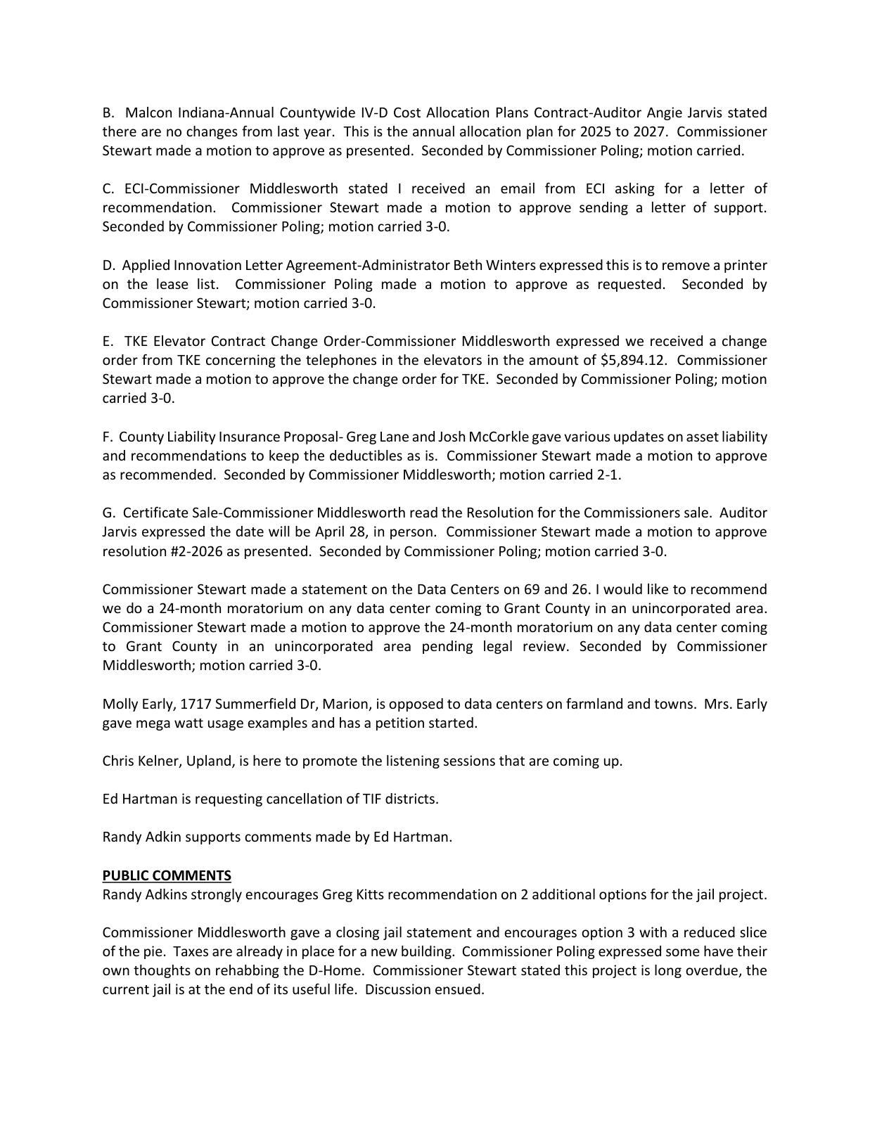
Page 3, the boxed lines. ourweek.in/records/data-centers/moratorium-moved.pdf
Scan to hear it said
Grant County Commissioners, March 2, 2026, at 53:08
https://youtu.be/Nx2IEEhOWYc?t=3188
Two weeks later it is an ordinance.
Grant County Commissioners · March 16, 2026 · page 3 · at 55:52
“Data Center Moratorium-Attorney Martin Harker drafted and explained the moratorium.”
Two weeks later it is an ordinance. The recording opens on attorney Martin Harker reading its own duration clause aloud, a few seconds before the motion.
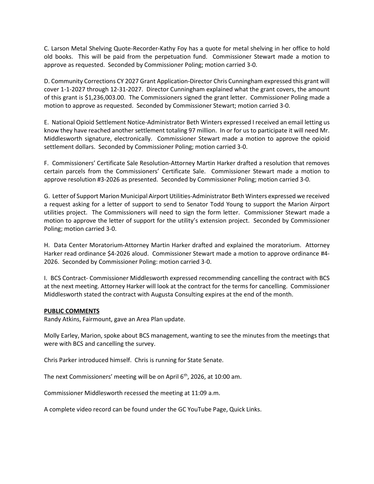
Page 3, the boxed line. ourweek.in/records/data-centers/moratorium-ordinance.pdf
Scan to hear it said
Grant County Commissioners, March 16, 2026, at 55:44
https://youtu.be/HSjMWfvjUNs?t=3344
Ordinance 4-2026 runs for twenty-four months — to March 16, 2028 — or until the county adopts an ordinance amending its zoning code, whichever comes first. The plan commission's data center subcommittee had held its first meeting five days earlier.
And the county says out loud what the room had become.
Grant County Commissioners · March 16, 2026 · at 1:04:32
“the public that was there doesn't trust the survey. They don't trust the BCS management”
"They don't trust the BCS management."
Scan to hear it said
Grant County Commissioners, March 16, 2026, at 1:04:20
https://youtu.be/HSjMWfvjUNs?t=3860
In April, the county sends the notice.
Grant County Commissioners · April 6, 2026 · page 3 · at 1:10:28
“Notice of Cancellation-BCS Management- Attorney Harker read the notice aloud.”
Attorney Martin Harker reads it out: the county is canceling the Exit 255 community listening sessions, effective immediately. His own next words are "No reason is given. No reason is stated in this notice." Augusta Consulting's contract had expired at the end of March; this is the other one.
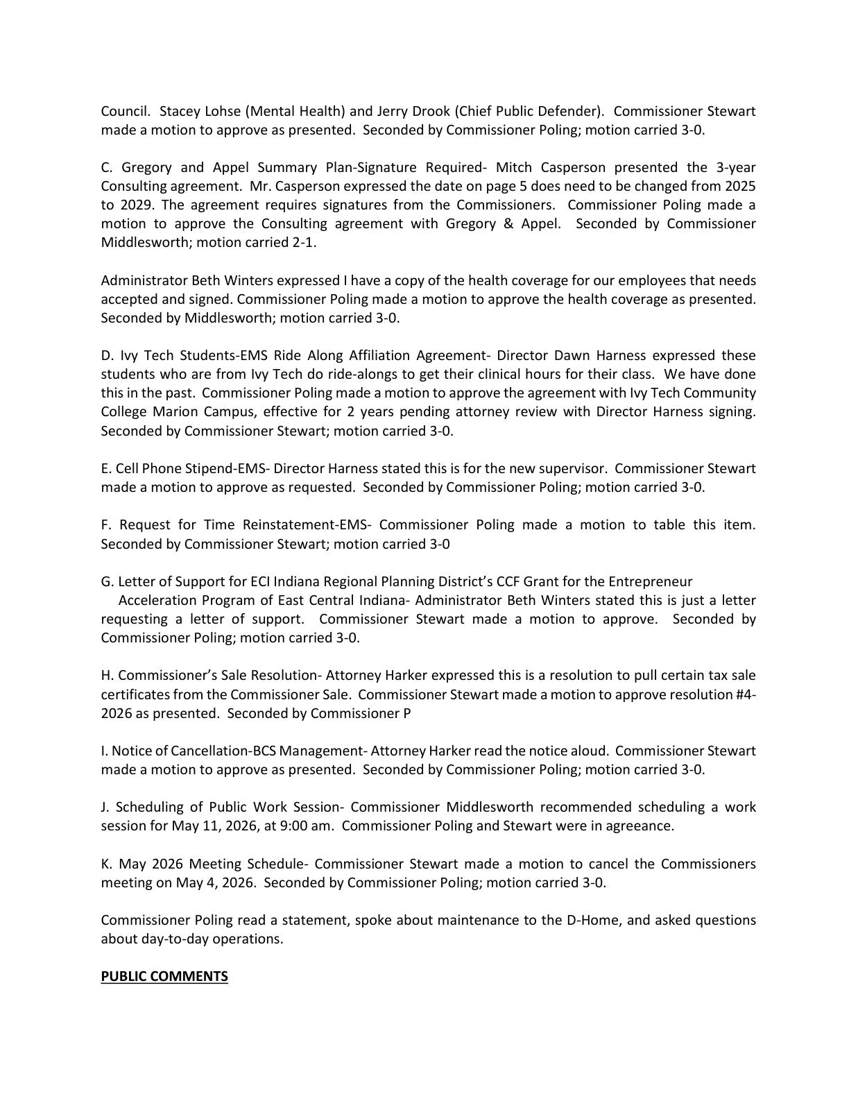
Page 3, the boxed line. ourweek.in/records/data-centers/bcs-cancelled.pdf
Scan to hear it said
Grant County Commissioners, April 6, 2026, at 1:10:22
https://youtu.be/TUw0RWoyCTA?t=4222
On the city side of the line
The moratorium governs unincorporated Grant County only, because it is a moratorium on improvement location permits and those are issued under a zoning chapter that says where it applies.
Grant County area-wide zoning ordinance · Ordinance 2-2000, as codified 2024 · page 98
“This chapter shall apply to all land within the unincorporated areas of the county.”
The zoning chapter's jurisdiction clause, in full.
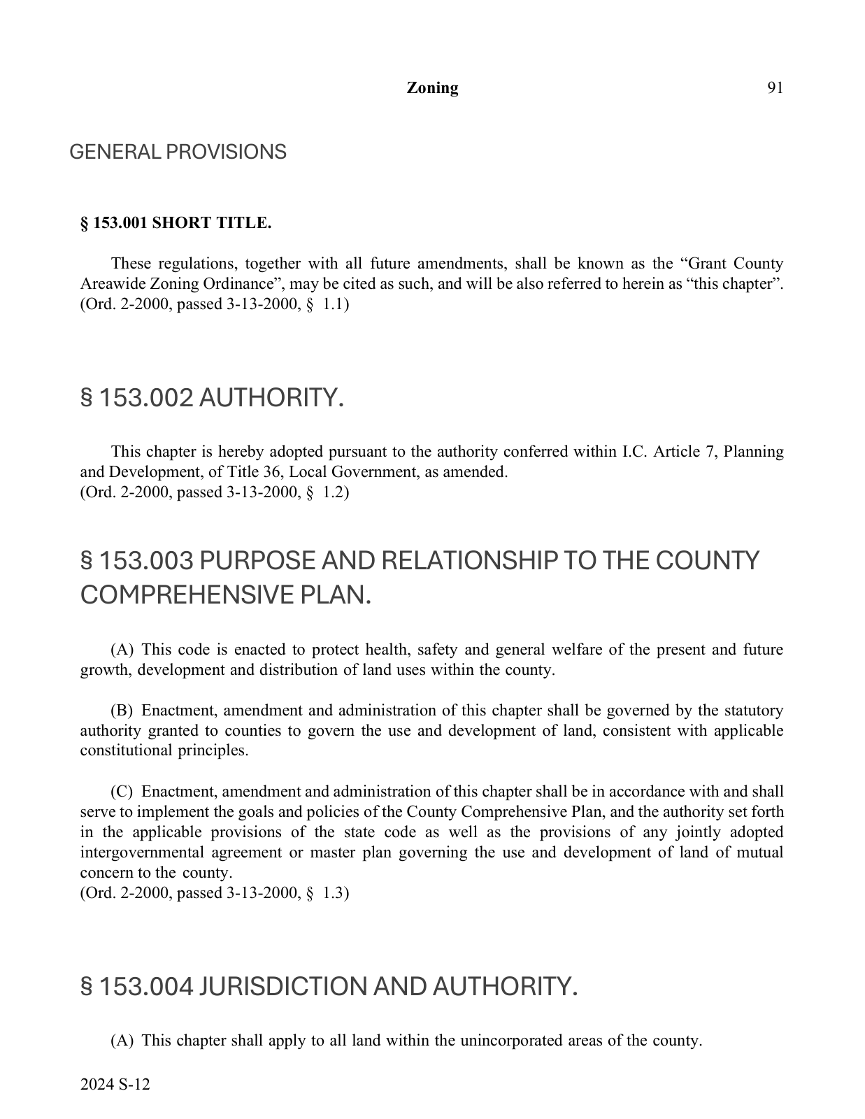
Page 98, the boxed line. https://www.in.gov/counties/grant/files/Area-Wide-Zoning-Ordinance-v1.pdf
Marion, Gas City and the towns write their own rules — and the location residents name most often in the meetings on this page is inside Marion. So the same argument shows up in the Marion council chamber, at a hearing about water rates.
Marion Common Council · March 17, 2026 · at 14:07
“the potential developments coming to the west side of Marion in regards to potential data centers that we all know”
One of only two instances we found in the Marion Common Council recordings.
Scan to hear it said
Marion Common Council, March 17, 2026, at 13:07
https://youtu.be/xU7TDaliHO8?t=787
The site nobody names
The project is public now. The site is not: the closest anyone in government has come is "West Marion," in the mayor's August 26 statement.
Until the mayor's August 23 statement, every official answer about location we found in the public record said the same thing: no specific site had been publicly identified. The county's data center subcommittee said so from the chair in June, drafting an ordinance it describes as being for the whole county and not for anywhere in particular.
Grant County Area Plan Commission · June 10, 2026 · at 56:45
“We don't have any knowledge of any specific site where a data center would be proposed to build at this time.”
Three months later, asked from the floor where a data center would go, the subcommittee answers.
Scan to hear it said
Area Plan Commission data center subcommittee, June 10, 2026, at 56:35
https://youtu.be/fBPiPZlRIxo?t=3395
Three months earlier, someone who lives and runs a business on Marion's west side stood at the same microphone and named one.
Grant County Area Plan Commission · March 11, 2026 · at 1:14:15
“I own the orchard across from Dana, which I've heard rumored for 2 years now. It's a proposed data center site.”
Public comment on the draft ordinance, March 11, 2026.
Scan to hear it said
Area Plan Commission, March 11, 2026, at 1:14:10
https://youtu.be/XdbMOMurlEo?t=4450
They were not the first to say it out loud. Nine days earlier, at the commissioners' meeting where the moratorium was moved, another resident had put a second location on the same corridor.
Grant County Commissioners · March 2, 2026 · at 1:06:34
“there's proposals out off of 18 by the GM plant as well for a data center, and to annex the last little bit of farmland over there into city limits”
The same speaker, moments later, describing ground inside Marion. The commissioners' reply: what happens inside the city is not theirs.
Scan to hear it said
Grant County Commissioners, March 2, 2026, at 1:06:26
https://youtu.be/Nx2IEEhOWYc?t=3986
Earlier still, and in a body nobody thinks to check. On October 28, 2025 — four months before either of them — the county drainage board finished its business and moved to adjourn, and a member spoke up.
Grant County Drainage Board · October 28, 2025 · at 25:49
“I did hear a lot of rumors, and I've talked to Pat and I've talked to Raymond, about Western Marion wanting to be a landing ground for — what is it? — a data center.”
October 28, 2025, after the motion to adjourn. The earliest west side rumor we found in the county’s recordings.
Scan to hear it said
Grant County Drainage Board, October 28, 2025, at 25:41
https://youtu.be/O8P5IOin_Ow?t=1541
Grant County Drainage Board · October 28, 2025 · at 26:33
“It's really the city deal, and we're just waiting on them to see what they're actually doing.”
The answer, which places that ground inside the city.
Scan to hear it said
Grant County Drainage Board, October 28, 2025, at 26:23
https://youtu.be/O8P5IOin_Ow?t=1583
Grant County Drainage Board · October 28, 2025 · at 27:28
“You know more than I do. I just got rumors. Rumors don't make fact.”
And how the exchange ends.
Scan to hear it said
Grant County Drainage Board, October 28, 2025, at 27:16
https://youtu.be/O8P5IOin_Ow?t=1636
Seven months later the plan commission drew the same boundary in plainer terms.
Grant County Area Plan Commission · May 4, 2026 · at 10:50
“If you're talking potentially data center talk in Marion, that's beyond the jurisdiction of what this board can do.”
The same meeting, earlier: what the county moratorium does not reach.
Scan to hear it said
Grant County Area Plan Commission, May 4, 2026, at 10:40
https://youtu.be/O4RfEjdKMXk?t=640
So the county moratorium covers the ground the county studied, and does not reach the corridor people keep naming.
The ground they describe is across the road from the closed Dana factory this report opened on. Rumored for two years, they say — which would put the talk in early 2024: before the study, before the moratorium, before the commissioners engaged the consultant who wrote about Exit 255.
No application has been filed. No company has been named. No county document proposes a data center at that address. What the record does hold starts earlier than the rumor's first appearance at a podium. In July 2025 the commissioners' economic development consultant reported active interest in the Dana ground itself — three entities, none named then or since.
Grant County Commissioners · July 7, 2025 · page 2 · at 7:59
“We have had three different entities that have said, 'Hey, yes, we are interested in that site.'”
Nothing in the update says what any of the three would build.
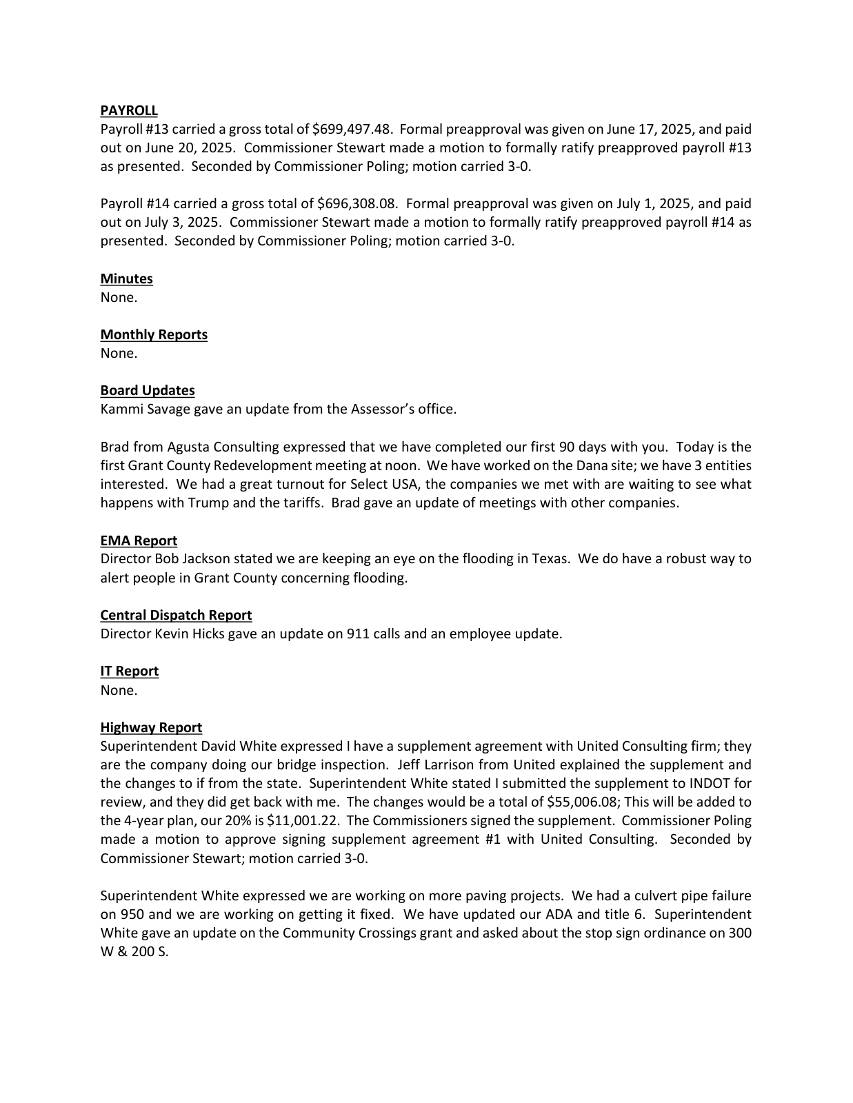
Page 2, the boxed lines. ourweek.in/records/data-centers/min-2025-07-07.pdf
Scan to hear it said
Grant County Commissioners, July 7, 2025, at 7:53
https://youtu.be/sWotMCsQzEQ?t=473
Interest in a closed factory site is what a county hires a development consultant to generate, and none of it says "data center." Two months later the county's own redevelopment commission had that ground on a map, working west across the city.
Grant County Redevelopment Commission · September 2, 2025 · at 21:29
“And then you have Dana. This is actually Dana here and then behind it, that portion is not in the city.”
"Are you thinking making a area to cover that west side to come down?"
Scan to hear it said
Grant County Redevelopment Commission, September 2, 2025, at 21:17
https://youtu.be/iFVYi0jMeyk?t=1277
Three months after that map discussion, the same ground stopped being a discussion. On December 1, 2025 the redevelopment commission passed a declaratory resolution for a west side economic development area, with its map attached and a base year of January 1, 2025 for capturing the increase in property tax. That resolution opens the statutory process rather than completing it: the map goes to the plan commission, and the commission takes final action afterward. Three months later it had not. "I did present the maps that this body had worked on for a while to the APC as one of the required steps of approval," the county's economic development consultant told the redevelopment commission on March 2, 2026. "They did not approve the westside map that was presented."
So the claim sits here: unconfirmed, and not ruled out. The ground has drawn interest from three unnamed entities in the county's own record, has been on a county map, and then inside the boundary the county proposed for a west side economic development area — a boundary the plan commission did not approve as drawn. And the people who live across from it have been hearing about it since before the Exit 255 study existed.
Eight hundred acres
The sheet at the top of this page reached OurWeek in August 2026, when Marion officials were giving it to community leaders for input. On August 23 Mayor Morrell published it himself. The copy he released is the one shown above, and it matches the copy we had — the same figures, line for line. It still carries no date, no author and no letterhead, and it is still not on file with any public body.
In the statement he posted with it, Mayor Morrell wrote that he had not signed a non-disclosure agreement, that Marion has about 12 million gallons a day of water capacity against about 3.5 million in use, and that he had been told the city has the electrical capacity for the project — pointing readers to Marion Utilities and to Indiana Michigan Power to check both for themselves. He also wrote that people with questions about the land should "talk to the property owners and farmers who have chosen to sell their land to the company." That is the first public statement we have found from anyone in government that owners have agreed to sell. He did not say who they are, where the ground is, or who the company is.
Past the headline figures, it puts approximately 200 permanent positions on the site — 50 full-time employees and 150 contractors — against 1,000 to 1,500 construction jobs per phase. It says the developer would fund all of the power, water and sewer infrastructure the project needs, and that approximately half the investment would be personal property rather than real property. Throughout, it says "the developer" and "the company."
It says the company "has voluntarily committed to work with the City of Marion to study potential noise and lighting impacts from the site."
Its vocabulary is not unusual. "Community impact payment" has been used in other Indiana data center agreements for money a company pays a local government alongside a tax abatement. At the LEAP district in Lebanon, the state's own economic development corporation says Meta committed to "an annual community impact payment of $1.5 million to the city of Lebanon for each completed phase" of a campus it puts at more than $10 billion. We looked for a published one-page summary elsewhere that matched this one in form or phrasing and did not find one. What is worth noting about Lebanon is the part this sheet does not have: the company was named.
It does not say where in Marion. The city is as specific as it gets — and the city is outside the county moratorium's reach.
The question nobody had asked out loud
The word was said in that room a year before anyone asked about it. On July 7, 2025 — before the study was delivered, before the moratorium — the commissioners' contracted economic development consultant, Brad Bookout, gave his regular update in open session:
Grant County Commissioners · July 7, 2025 · page 2 · at 9:16
“We've been in touch with another confidential prospect that I've spoke with you all confidentially under an NDA at this time.”
The minutes reduce this stretch of the update to one line: "Brad gave an update of meetings with other companies."
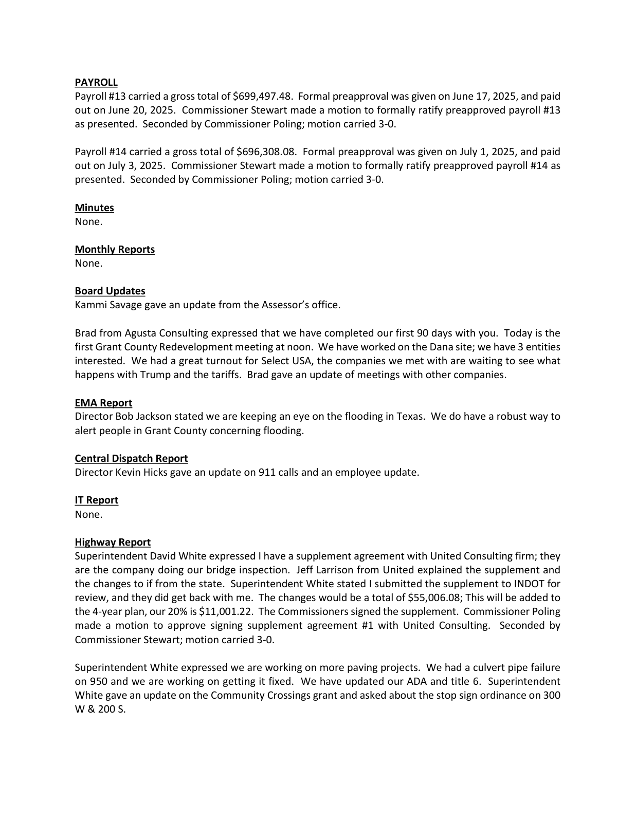
Page 2, the boxed line. ourweek.in/records/data-centers/min-2025-07-07.pdf
Scan to hear it said
Grant County Commissioners, July 7, 2025, at 9:10
https://youtu.be/sWotMCsQzEQ?t=550
He does not say who the prospect is, who signed the agreement, or what it covers — and nothing in the sentence establishes that any commissioner signed anything. A confidentiality agreement held by a contractor binds the contractor. What the sentence establishes is narrower: by July 2025 there was a prospect the county's own consultant would discuss with the commissioners only confidentially, under an NDA.
Ten months later a resident started asking. Michael Duke of Bradford Pike — his name is in the official minutes of both bodies — put the same question to three county bodies in seventeen days: had the officials in front of him signed a non-disclosure agreement, and if so, would they disclose it.
At the plan commission on May 4, first:
Grant County Area Plan Commission · May 4, 2026 · at 20:05
“Has anybody on the APC been asked to sign an NDA by any corporate entity?”
May 2026. A resident asks the plan commission, in public comment, on the record.
Scan to hear it said
Grant County Area Plan Commission, May 4, 2026, at 19:51
https://youtu.be/O4RfEjdKMXk?t=1191
Grant County Area Plan Commission · May 4, 2026 · at 21:54
“We don't sign them.”
The answer, and then the board works through its own rule: if a member were asked, they would have to tell the board.
Scan to hear it said
Grant County Area Plan Commission, May 4, 2026, at 21:48
https://youtu.be/O4RfEjdKMXk?t=1308
In the same comment he said that officials at the city of Marion have been heard to say they signed such agreements. That part is his account. We have not located the record he refers to, and this page does not carry it as fact.
At the commissioners on May 18, he asked them to answer, and one did:
Grant County Commissioners · May 18, 2026 · page 3 · at 43:38
“No, I haven't signed any.”
The official minutes record both the question and the answer.
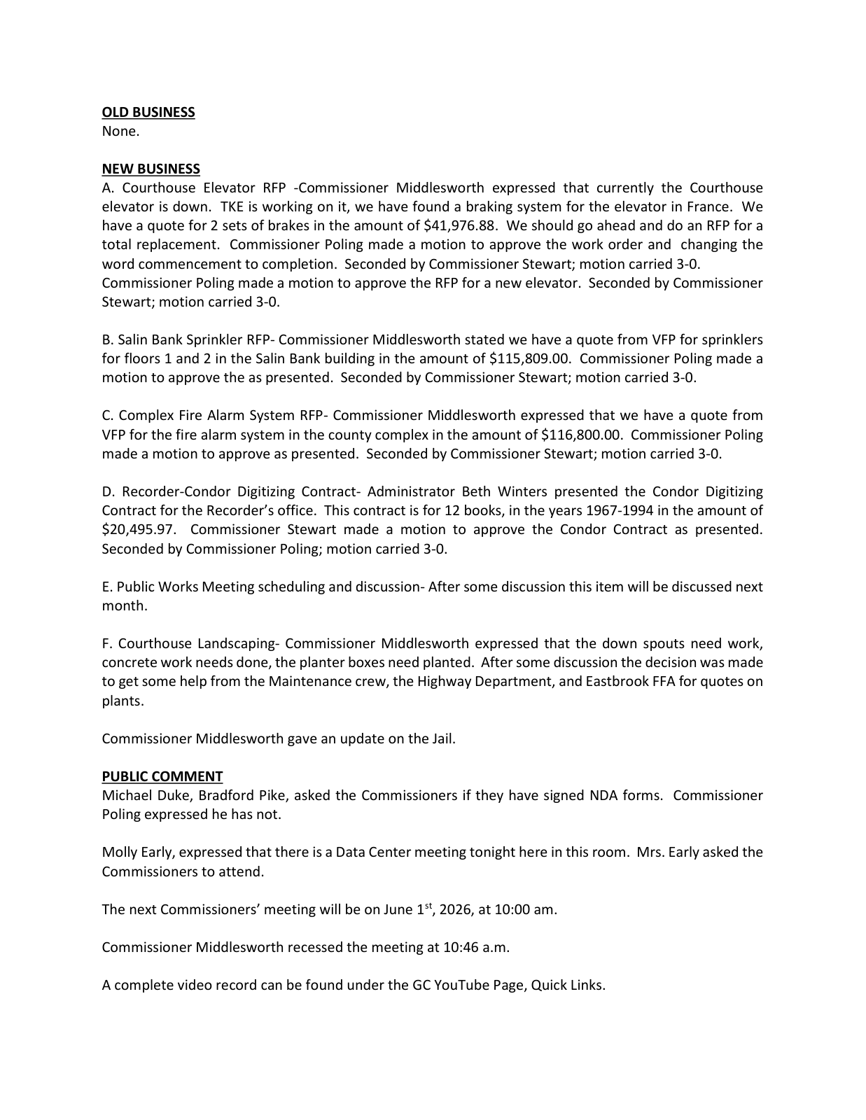
Page 3, the boxed lines. ourweek.in/records/data-centers/nda-poling-answer.pdf
Scan to hear it said
Grant County Commissioners, May 18, 2026, at 43:30
https://youtu.be/dpV4co7N3bg?t=2610
At the county council on May 20, the first member to answer said he had not signed one and had not been asked to — and then wondered aloud whether a signed NDA would have to be disclosed on the conflict-of-interest form officials already file each year. The council's attorney offered that a body like the council would rarely see one, a tax abatement for a project in the unincorporated county being the likeliest path he could name. The table's own memory produced exactly one candidate from decades of county business — the Walmart distribution center — and nobody could recall signing anything even then.
Grant County Council · May 20, 2026 · page 2 · at 1:57:58
“I'll tell you, I haven't signed an NDA. I haven't been asked to sign one.”
The minutes record the question. The answers are on the recording.
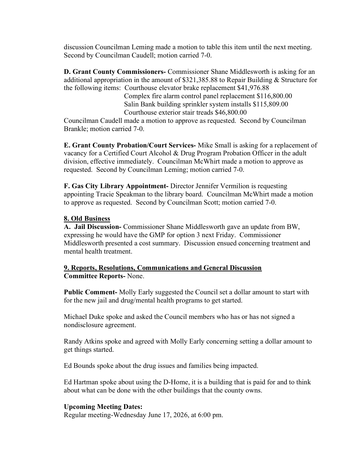
Page 2, the boxed lines. ourweek.in/records/data-centers/nda-council-question.pdf
Scan to hear it said
Grant County Council, May 20, 2026, at 1:57:54
https://youtu.be/g_bpC0IscGg?t=7074
So the record now holds four answers, and they agree. The plan commission answered no as a body. Commissioner Poling answered no, and the minutes print it. A council member answered no on the recording. Mayor Morrell wrote that he has not signed one. Every answer on the record is no — and the county's own consultant said, in open session in 2025, that he had briefed the commissioners on a prospect "confidentially under an NDA." Those two things can both be true at once. Whose signature is on that agreement, and what it covers, is written on a piece of paper somewhere, and not in the public record.
The subcommittee drafting the county's data center ordinance has already addressed what an NDA will be worth against its disclosure requirements:
Grant County Area Plan Commission · July 29, 2026 · at 1:34:00
“An NDA won't get you out of answering the questions. Is that what we're saying? — That's what I'm trying to say here.”
Drafting the ordinance's disclosure section, July 29, 2026.
Scan to hear it said
APC data center subcommittee, July 29, 2026, at 1:33:50
https://youtu.be/1wmU8EFyy6k?t=5630
Written minutes summarize a meeting; they do not transcribe it. That is why forty-eight of the sixty-five sources on this page are recordings. The plainest case is above: a sentence about an NDA, spoken to the commissioners in open session, survives only on the recording — the minutes for that morning say "an update of meetings with other companies."
The one company that wrote the plan commission
In June 2026 the area plan office received an email. Its director called it "the first communication the APC office has received concerning building or establishing a data center in Grant County," and read it into the minutes.
Grant County Area Plan Commission · June 24, 2026 · at 1:43:41
“This is the first communication the APC office has received concerning building or establishing a data center in Grant County”
"This is the first communication the APC office has received."
Scan to hear it said
Grant County Area Plan Commission, June 24, 2026, at 1:43:27
https://youtu.be/qzAt5Nb9Bbk?t=6207
He then said what it was not.
Grant County Area Plan Commission · June 24, 2026 · at 1:45:12
“It is not an application. It is not an approval. It is not a pilot project designation. It is not a waiver of the moratorium.”
And says plainly what it is not.
Scan to hear it said
Grant County Area Plan Commission, June 24, 2026, at 1:45:02
https://youtu.be/qzAt5Nb9Bbk?t=6302
Grant County Area Plan Commission · June 24, 2026 · at 1:46:06
“The reason this communication is being placed in the public record tonight is very simple. This topic is important to Grant County. And the APC office intends to handle communications related to potential data center development openly and transparently.”
Then why he was reading it aloud at all.
Scan to hear it said
Grant County Area Plan Commission, June 24, 2026, at 1:46:00
https://youtu.be/qzAt5Nb9Bbk?t=6360
Grant County Area Plan Commission · June 24, 2026 · at 1:46:53
“Proper process, transparency, and respect for the rule of law are not obstacles to economic development. They are the foundation for it.”
Forty seconds later, still on his feet.
Scan to hear it said
Grant County Area Plan Commission, June 24, 2026, at 1:46:47
https://youtu.be/qzAt5Nb9Bbk?t=6407
Nine months earlier the same subject carried a different instruction, in a study the commissioners paid for: soft-pedal the data center idea in all public documents, and secure land options before any announcement. The area plan commission is a separate body, with its own director, its own staff and its own meetings. The commissioners also assign one of their own three to sit on it each year, and its zoning ordinances come back to them to be adopted.
Here is the email itself.
Recore Digital · June 15, 2026 · page 2
“a 24-month moratorium is an exceptionally long timeline for active investment capital”
The original, sent June 15, 2026 at 2:27 PM. Personal addresses were redacted before release.
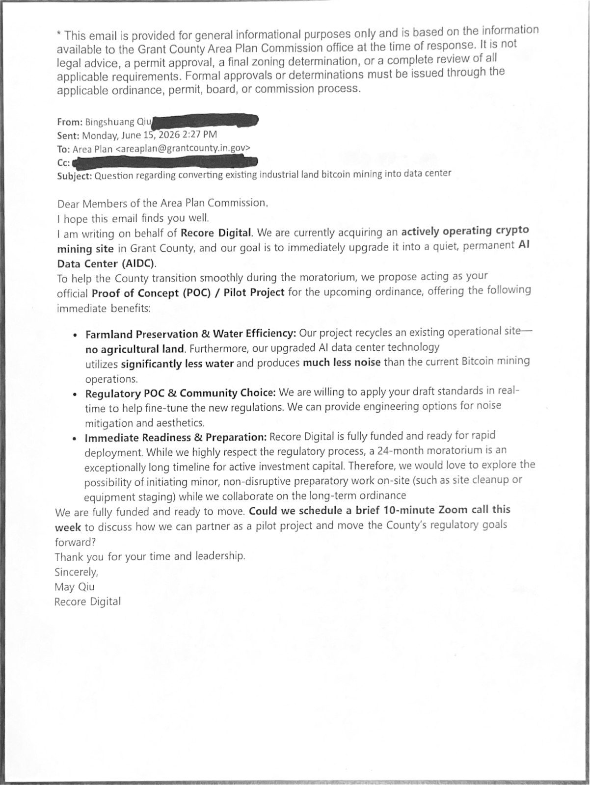
Page 2, the boxed lines. ourweek.in/records/data-centers/recore-digital-email.pdf
It is not a farmland proposal. It is a proposal to buy what the letter describes as an existing crypto-mining site already operating in the county — "our project recycles an existing operational site, no agricultural land" — and convert it to what the letter calls a quiet, permanent AI Data Center. It offers to serve as the county's official proof of concept for the ordinance being drafted, and closes by asking for a ten-minute Zoom call that week.
The county's entire reply, sent the next afternoon, was five words.
Grant County Area Plan Commission · June 16, 2026 · page 1
“Your Email has been received.”
The county's entire reply, sent the next afternoon.
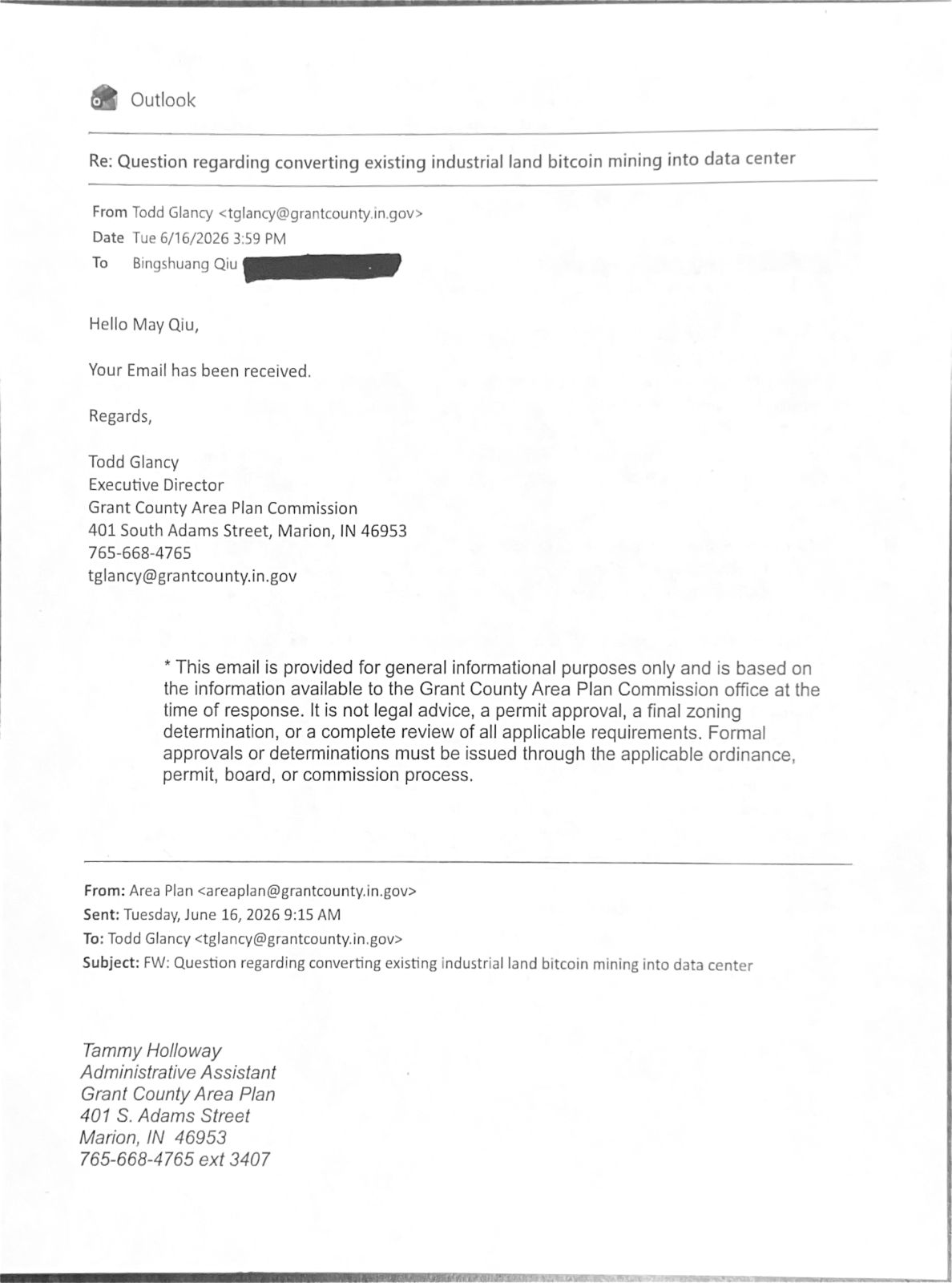
Page 1, the boxed line. ourweek.in/records/data-centers/recore-digital-email.pdf
A website under that name, recoredigital.ai, runs on a domain registered on May 15, 2026 — a month before the email.
Recore Digital · August 21, 2026 · page 2
“Our flagship campus is currently under conversion from a former mining facility.”
The company's own projects page, as it stood on August 21, 2026.
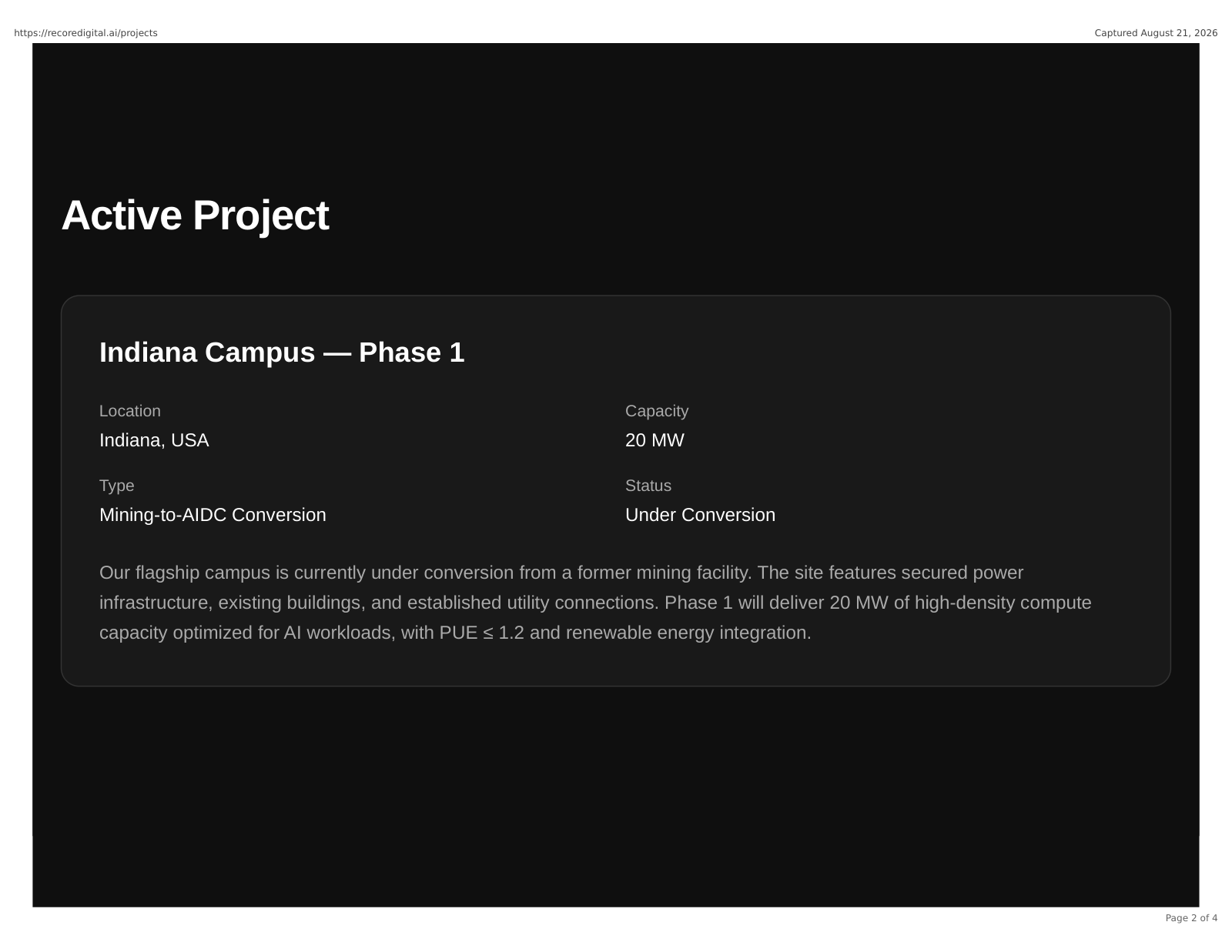
Page 2, the boxed lines. ourweek.in/records/data-centers/recore-projects-page.pdf
Headquarters is given as "North America." The site names no street address, no person, and no county. Indiana is the most specific location on it.
A year later, in the budget
August 2026. The county council spends two nights on the 2027 budget, and on the second night it works through the commissioners' contractual services line — $300,000, and nobody at the table is certain what is inside it. The list is read out. Two of the names on it are the two firms this story has been following.
Grant County Council · August 20, 2026 · at 1:58:05
“Augusta Consulting was paid out of that.”
The commissioners' contractual services line, being read through at the 2027 budget hearings.
Scan to hear it said
Grant County Council, August 20, 2026, at 1:57:57
https://youtu.be/NF0K5_yBiwQ?t=7077
BCS Management was paid from the same line. Asked whether the county is still under contract with the consultant, the table gets a flat answer.
Grant County Council · August 20, 2026 · at 2:05:32
“We did not renew with him.”
The arrangement ended over the summer.
Scan to hear it said
Grant County Council, August 20, 2026, at 2:05:22
https://youtu.be/NF0K5_yBiwQ?t=7522
The council cut the line to $150,000. Members work the annual amounts out loud as they go, arriving at six different figures in about ninety seconds; none of them is printed here, because arithmetic done from memory at a budget table is not a contract. What the record carries is that both firms were paid from that line, that the consultant's arrangement ended, and that the line for 2027 is half what it was. It does not say why. Nobody at the table could say either — the budget had been assembled by a commissioner who has since left the board.
The mayor says it is real, then won't endorse it
On August 23, 2026, Marion's mayor put the sheet at the top of this page on his own Facebook page, under a statement that opens: "As promised, if and when this deal became real, I said the details would be made available to the public. That time has come."
Mayor Ronald Morrell Jr. · Posted August 23, 2026; captured the same day · page 1
“As promised, if and when this deal became real, I said the details would be made available to the public. That time has come.”
The statement as it stood on his page, captured the same day.

Page 1. ourweek.in/records/data-centers/morrell-statement.pdf
It is the first statement we have found from anyone in government that a project is real. His post is at facebook.com/share/p/1BSgvQeLeC; because a post can be edited or taken down, the whole of it is also saved as it stood — five screens, with the sheet attached below the text on the last one.
He answers a list of things directly. He has not signed a non-disclosure agreement. He is not running for another office, has not been paid by anyone and is not moving. He says Marion has about 12 million gallons a day of water capacity against about 3.5 million a day in use, and that he has been told the city has "sufficient power capacity" — and in both cases tells people not to take his word for it, but to ask Marion Utilities and Indiana Michigan Power themselves. The two are not equally checkable. The water claim carries figures, and those figures have a public source. The electrical claim carries no figure, and he does not say who told him.
The water figure has a public source, and it is older than the statement. It comes from the city's own witness, under oath, in Marion's 2023 water rate case before the Indiana Utility Regulatory Commission.
Indiana Utility Regulatory Commission · Order of August 2, 2023 · page 2
“The raw water source consists of groundwater from 12 production wells, and the existing water treatment facility has a maximum treatment capacity of 12,000,000 gallons per day.”
Sworn testimony in the city's 2023 rate case. The same page records one booster pump holding pressure along State Road 18 out to Interstate 69.
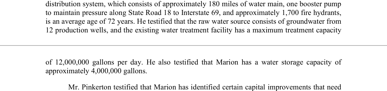
Page 2, the boxed lines. https://www.in.gov/iurc/files/ord_45838_080223.pdf
The utility says the same thing on its own website, and puts the wells at the same twelve.
Marion Utilities · The utility's own page, captured August 24, 2026 · page 2
“About 4 million gallons of safe, clean drinking water are then pumped to about 11,000 residents, businesses and industrial users every day.”
About four million gallons a day, to about 11,000 users.
Page 2, the boxed lines. ourweek.in/records/data-centers/marion-water-utility.pdf
Both figures predate this project, and neither is a statement about what the plant can spare in 2026 — which is the question, and the one he says to put to the utility.
On the land, he wrote:
"If you have questions about the land involved, talk to the property owners and farmers who have chosen to sell their land to the company. Without willing landowners, this project cannot happen."
That is the first public statement we have found from anyone in government that owners have agreed to sell. It does not say who they are, how much ground, or at what price.
He gives a reason for pursuing it, and it is a budget. Marion, he says, expects to lose about $8 million from a roughly $34 million budget beginning in 2029 under Senate Enrolled Act 1, the property tax law the General Assembly passed in 2025 — a law whose fiscal analysis projected local units across Indiana losing about $1.5 billion over three years. He lists three ways out: cut services and staffing, ask taxpayers for more, or grow the tax base. He does not claim to know that this is the right one. "Is this the best deal for Marion? I truly don't know."
And after two thousand words releasing the details, three things are still not in them. He does not say "data center." He does not name the company. He does not say where in Marion the eight hundred acres are.
Three days later, two of the three arrived. On August 26 the mayor released a second statement: his administration "was approached regarding the potential development of a hyperscale data center in West Marion," his team "entered into discussions to pursue the opportunity through due diligence and negotiation" — and, "after careful consideration, extensive evaluation, significant effort, and feedback from the public," he has "determined that this particular proposal is not the right fit for the city, and I will not be endorsing it." He added: "Over the past several days, it has become clear that this is not the direction the citizens want."
Mayor Ronald Morrell Jr. · Released August 26, 2026 · page 1
“I have determined that this particular proposal is not the right fit for the city, and I will not be endorsing it.”
His post is at [facebook.com/share/p/1Fn2tsTZX8](https://www.facebook.com/share/p/1Fn2tsTZX8/); the statement is saved here as released.
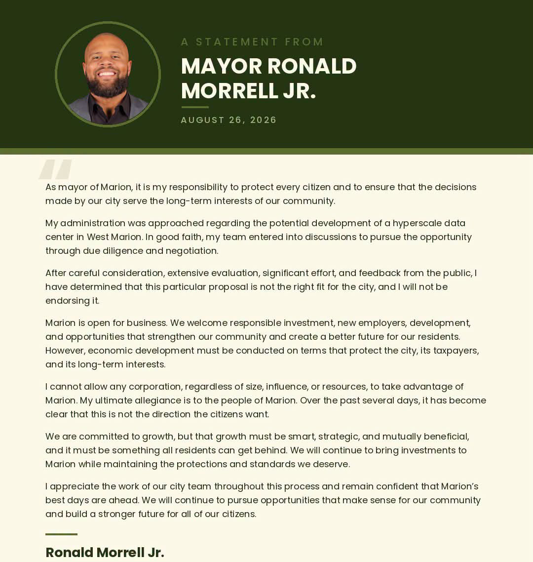
Page 1. ourweek.in/records/data-centers/morrell-aug26.pdf
So the words "data center" — hyperscale, at that — and a location, West Marion, are now the mayor's own. What the second statement does not do matters as much as what it does. It does not say the proposal has been withdrawn, only that he will not endorse it. It does not name the company — no government document yet has; the mayor did, in an interview, two days before. And "West Marion" is a direction, not a parcel: the Dana claim stands where it has stood. What a mayor's no reaches, and what it cannot reach, is taken up under "What happens next."
The name came in the Chronicle-Tribune. The paper spoke with the mayor on August 24 — the day after his release, two days before his reversal — and he answered the "done deal" rumor directly: "no deal has been presented to the City Council, and therefore, any suggestion that this project is 'already a done deal' is simply not accurate. Additionally, we are not moving forward with the Oct. 6 meeting at this time." Then, declining to speak for the developer, he named it: "Any updates regarding this project should come directly from Meta or its representatives, not from the City of Marion." And again: "If Meta wants to locate in Marion, then Meta bears the responsibility of presenting its vision to our community, answering the public's questions and demonstrating its willingness to be a strong and responsible community partner."
That is the first time anyone in government has named a company, and it is worth being precise about what it is and is not. It is the mayor's word, on the record, to a newspaper. No document carries the name — not the sheet, not a filing, not anything from the company itself, which has said nothing publicly about Marion.
In a follow-up interview on August 27 he went past the non-endorsement: "Based on that feedback, I will not be pursuing or supporting data center development in the City of Marion under my administration." He also widened his NDA answer — he has not signed one "related to Project Riverjump or data center development," and is "not aware of any City of Marion staff members who have signed such an agreement" — and drew its boundary himself: "I cannot speak to whether individuals or officials outside of the City of Marion, including those at the county level or within other organizations, entered into NDAs."
What the land records show
The claim that farmers have already been quietly paid — roughly $200,000 apiece, held in escrow — is checkable in one direction, and it was checked.
We pulled the owner of record, assessed use and transfer history for every parcel in the three areas the county studied or mapped — the I-69 and SR 26 interchange at Exit 255, the SR 18 corridor west of Marion, and the Miller Avenue quadrant. That is 1,753 parcels, 14,067 acres, 11,879 of it farm ground.
The study named the three largest landowners near the interchange, in a section listing stakeholders. It did not say those were the parcels to option — it says precise parcel identification is impracticable and that it deals generally with the area around the interchange. None of the three has sold anything. Central Indiana Grain Farm IV LLC holds 466 acres and last took title in 2011. Lasater Family Land LLC, 210 acres, 2020. Chalk Hill Farms Inc, 166 acres, 2016. Fifteen months after the same document recommended securing land options before any public announcement, all three are still on their ground.
Across all three areas, 282 parcels changed hands since January 2024, and the large ones are almost entirely families conveying to themselves — Wright to the Wright trust, Seward to the Seward family trust, Patricia Smith's 145 acres re-deeded to herself. Among the 1,718 parcels whose ownership records resolved: no new entity, no out-of-state newcomer, no adjoining parcels moving together in a window.
We also checked every owner name — 1,255 of them — against the county clerk's roster of elected officials, all 185 entries, which run from the federal ballot down through the county offices to township boards, town councils and school boards. That is more than the 178 offices our NDA canvass puts a question to, which leaves out the presidential ticket and the six elected judges. No county officeholder appears among the 1,255 owner names we checked. Not the Campbells, who sold into the grain farm entity in 2002; not the Lasaters; not Kelsay Farms, which sold Chalk Hill its two parcels in 2016.
Town and school officials do appear, which is what farm country looks like. The mapped areas take in Fowlerton, Jonesboro, Fairmount and Sweetser, and people who serve on those councils and boards own property in them — house lots for the most part, and in one case a few hundred acres of farm ground near the interchange. None of those offices has a vote on county zoning, on the redevelopment commission, or on the study. And the check matches names only: an official holding ground through a company would not appear in it, and the principals behind the three interchange entities were never obtained.
And here is the limit. Indiana law does not require an option to be recorded, so one can exist for years without creating a county record. These records can rule out a completed assembly. They cannot rule out one still in the option stage — which is precisely the stage the study recommended. So that claim stands where it stands: unconfirmed, not ruled out. Two records would ordinarily surface a completed transaction, and both are public. A sales disclosure form, ordinarily filed when property is conveyed for valuable consideration, and searchable by buyer name. And a lease longer than three years, which must be recorded within forty-five days — and ground leases for developments of this size can run for decades.
Common claims, and where each one stands
Confirmed by the record.
- The county paid for a study that recommended soft-pedaling a data center and securing land options before any public announcement.
- A sitting commissioner presided over the redevelopment commission that mapped Exit 255.
- That commission discussed TIF boundaries at the interchange from August 2025, before any company appeared in its public record.
- One company has written to the county. It wants an existing crypto site, not new ground.
- A one-page summary describing a $2 billion, roughly 800-acre technology campus in Marion was given by Marion officials to community leaders for input in August 2026, and published by Mayor Morrell himself on August 23.
- Marion's mayor says the deal is real, that landowners have agreed to sell to a company, and that he has not signed a non-disclosure agreement.
- On August 26 the mayor said he will not endorse the proposal, describing it as "a hyperscale data center in West Marion." His August 23 release had used neither the words nor the location. The second statement does not say the proposal is withdrawn, and still names no company.
- In interviews published by the Chronicle-Tribune on August 27, the mayor named Meta as the company to answer for the project, said no deal has been presented to the city council, and said he will not pursue or support data center development in Marion under his administration.
- Every answer to the NDA question on the record is no: the plan commission as a body (May 4, 2026), Commissioner Poling in the commissioners' minutes (May 18), a county council member on the recording (May 20), and Mayor Morrell in writing (August 23; expanded August 27 — himself, and to his knowledge his staff, while saying he cannot speak for officials outside the city, the county included).
- In July 2025 the county's contracted economic development consultant told the commissioners, in open session, that he had discussed a prospect with them "confidentially under an NDA." Who signed that agreement, and what it covers, is not in the record.
Contradicted by the public record.
- That the study was never about data centers — it has a section headed "The Data Center Dilemma."
- That county officials never discussed Exit 255 in public — the redevelopment commission discussed it in open session from August 2025.
- That county officeholders own the land at Exit 255 — none appears as an owner of record among the 1,255 names checked. A name check cannot see an interest held through a company, so what this settles is the ownership record and not every possible interest.
Unconfirmed, not ruled out.
- A data center at the old Dana plant on Marion's west side. No filing exists, Mayor Morrell did not say where the ground is, and the sheet does not either. The ground people name sits inside the boundary proposed for a west side economic development area in December 2025 — which the plan commission did not approve as presented — on a corridor three people have named aloud in public meetings. In July 2025 the county's consultant reported three unnamed entities interested in the site; nothing in that update says what any of them would build.
- Escrow payments to farmers. The mayor says owners have agreed to sell; he did not describe the terms, and an agreement to sell is not the same instrument as an escrow payment.
- A specific price per acre for any official's land.
- That Meta is in fact the developer. The mayor's naming of it is on the record; nothing else is. No document carries the name, and the company itself has said nothing publicly about Marion.
- Money promised to the schools and then withdrawn.
Several of these would leave a public document if they reached a sale, a lease, a filing or a formal county action, and none has surfaced. At the option or exploratory stage, some would leave no public record at all. Absence of a record is not proof of absence when the instrument in question need not be recorded before it closes — and securing options before any public announcement is exactly what the county's own study recommended.
How it has gone elsewhere
Grant County is not the first Indiana county to take up the question of data centers, and five earlier ones left a public record of how it went. None of them says what will happen here. What they show is the order the documents arrived in, and how long it ran between the first public step and the day anyone learned whose project it was.
| County | The first public step | The name it went by then | Who it turned out to be, and how long after that first step |
|---|---|---|---|
| Allen (Fort Wayne) | October 2023 — annexation and rezoning sought for an "unnamed Fortune 100 company" | Project Zodiac | Google — named January 2024, three months later |
| St. Joseph | November 2023 — a survey contract, then a 1,500-acre development area | Razor5 LLC | Amazon — named April 2024, five months later |
| Morgan | January 2025 — a rezoning petition for 390 acres | Project Louie, through Woodland Caribou LLC | Google — named October 2025, nine months later |
| LaPorte (Michigan City) | 2025 — a taxpayer agreement for a data center exemption at 402 Royal Road | Project Maize, through Lavendar Fields Holdings LLC | Still not named |
| Shelby (Shelbyville) | 2026 — an economic development agreement, with annexation and rezoning | No code name | Prologis, named in the agreement itself |
| Grant | None on file | Project Riverjump | Still not named |
Allen County. In October 2023 an "unnamed Fortune 100 company" proposed a data center campus around Adams Center and Paulding roads outside Fort Wayne, requiring the annexation of more than 700 acres into the city. Through the annexation and the rezoning it was known only as Project Zodiac. WFYI reported that "in January 2024, after everything was finalized, the anonymous company's name was released" — Google, with up to twelve buildings. The developer of record was Hatchworks LLC, a Google subsidiary; a separate entity, DMI FW LLC, bought the property for it.
St. Joseph County. In November 2023 the county redevelopment commission approved a contract with Razor5 LLC to survey up to 800 acres near New Carlisle — $1 million in escrow for the survey rights alone, before any price had been discussed. WVPE reported that "County officials have not said what company Razor5 represents and the contract requires confidentiality until discussions for a sale move further along." Two days later the county council voted 8-1 to add about 1,500 acres to the New Carlisle Economic Development Area, over residents' objections, which put 309 properties on a property acquisition list. The company was named five months later: Amazon, $11 billion.
Morgan County. The Indiana Daily Student reconstructed that sequence from filings, minutes and litigation and published it as a dated timeline. A developer approached the county's economic development director in the first quarter of 2024. A company called Woodland Caribou LLC was formed in Delaware that June. By the end of August, two landowners had signed agreements restricting sale to it. The plan director signed a non-disclosure agreement in October; the county commissioners signed theirs in December. A rezoning petition for 390 acres was filed in January 2025 and approved 3-0 the following month, the developer still anonymous. In May the county granted a ten-year, fifty percent property tax deduction — to the LLC. Google was not confirmed as the company behind it until October 2025, eight months after the rezoning and five after the tax break.
The code name is part of the convention. Morgan County's was Project Louie, held through Woodland Caribou LLC. In that case and in Fort Wayne's, the company turned out to be Google. Nothing in the record connects Project Riverjump to Google or to any other company. What those two code-named projects establish is the sequence: the code name comes first and the company comes last.
Two more Indiana projects sit either side of that pattern. Michigan City's council approved a taxpayer agreement for "Project Maize," a data center campus at 402 Royal Road — an $800 million commitment and 30 full-time jobs, taken under the state's data center exemption, with the applicant given as Lavendar Fields Holdings LLC. Michigan City's own project page is headed "Phoenix Investors / Project Maize" and says "Phoenix Investors and its end-user are proposing" it — so the developer is named and the data center end-user is not. Shelbyville went the other way entirely: its 2026 agreement for a multi-phase campus of up to eleven buildings, at about $2 billion, names Prologis in the document itself — a California real estate investment trust, appearing with an annexation and a rezoning and no code name at all. So the sequence is a practice, not a rule. Some Indiana projects arrive with the company's name on the first page.
The three completed sequences are not unique. A Wisconsin Watch investigation found at least four Wisconsin projects developed after local officials signed non-disclosure agreements; Microsoft has since said it will stop signing them with local governments, while continuing to use them for land acquisition. In Oklahoma, The Frontier documented Sand Springs annexing 827 acres in June 2025 without telling residents Google was looking at the ground.
What the three completed sequences have in common is the order. An annexation, an economic development area, or a survey contract first. Then an option or a purchase agreement with an entity nobody can identify. Then a filing, a published notice, a hearing. The name last — three months after the annexation in Allen County, five months after the development area in St. Joseph, nine months after the rezoning petition in Morgan. Every governmental step in that sequence is a posted meeting with a recorded vote. The private land agreements are not. None of them requires anyone to say the name.
Where the visible record puts Grant County. A contracted economic development office, since April 2025. A study the county paid for, dated September 20, 2025, recommending that land options be secured before any announcement. An economic development area adopted at the interchange that study covers, and a second proposed on Marion's west side that the plan commission did not approve as drawn. And then, nowhere we can find it: a rezoning petition, a published notice, a hearing, an annexation, a shell entity that has bought anything, or any company named in a government record — except the one that wrote asking about a crypto site that already exists. If Grant County is following a similar pattern, the visible record would place it before the filing — the stretch in which those counties' steps had not yet produced a county record. The county has said consistently that it has no project before it. The mayor's August 23 statement establishes that a project exists in Marion; what it does not establish is whether, or when, that project would require a county filing at all. A project inside the city may never need one — which would account for the apparent contradiction in the public record without anyone in county government having said anything untrue.
One thing here has no counterpart in either case. In Morgan County and St. Joseph County the confidentiality sits in contracts and non-disclosure agreements between the parties, and the public read about it afterward. In Grant County, the recommendation to soft-pedal the subject in all public documents is printed in a study the commissioners paid for and released.
What happens next
Monday, September 14 — a town hall was held at REAL Community Covenant Church, 1240 South Adams Street in Marion, convened by a group calling itself Concerned Citizens of Marion & Grant County. It was open to the public, and the speakers announced beforehand were Rev. Andrew Morrell, Molly Earley and Rev. Tanya Smith; the church added a note that it does not endorse any political figure or party. Its lead pastor had confirmed to the Chronicle-Tribune after the mayor's reversal that the meeting would go ahead: "Although Project Riverjump may be dead, the conversation isn't."
Concerned Citizens of Marion & Grant County · Obtained by OurWeek, August 2026 · page 1
“Discussing the proposed Data Center at Marion's Former Dana Corporation.”
"Discussing the proposed Data Center at Marion's Former Dana Corporation."

Page 1. ourweek.in/records/data-centers/townhall-flyer.pdf
The flyer puts the two halves of this story on one page: the code name from the mayor's sheet, and the Dana site. A citizens' group is doing that, not a document. No application, no company and no county record places a data center at that address, and the claim stands where it has stood since March — unconfirmed, not ruled out.
Tuesday, October 6 — the Marion Common Council's first regular meeting of the month. The council meets the first and third Tuesdays. Rev. Morrell wrote publicly that he had been told the proposal is expected to come before the council around that date. The mayor told the Chronicle-Tribune on August 24 that no deal has been presented to the council and that "we are not moving forward with the Oct. 6 meeting at this time." Whether anything reaches a posted council agenda is now the thing to watch; agendas go up a few days ahead.
The petition, and the council's first word. A petition on Change.org asking that no data center be built in Grant County — addressed to Mayor Morrell and council members David Cain, Jim Brunner and Brian Cowgill — opened August 24 and reached 1,084 signatures by August 29. On August 26, the day of the mayor's non-endorsement, David Cain of District 6 answered it: "My understanding is that the Data Center is not moving forward." It is the first word from any Marion council member on the record about this project. An understanding is not an announcement, and no other member has answered.
David Cain, Marion City Common Council, District 6 · August 26, 2026 · page 1
“My understanding is that the Data Center is not moving forward.”
The first Marion council member on the record about the project, answering a petition that asks the council and the mayor to prevent data center construction in Grant County. His answer is his understanding, given the same day as the mayor's non-endorsement; Change.org notes it arrived as an email to its civic engagement team.
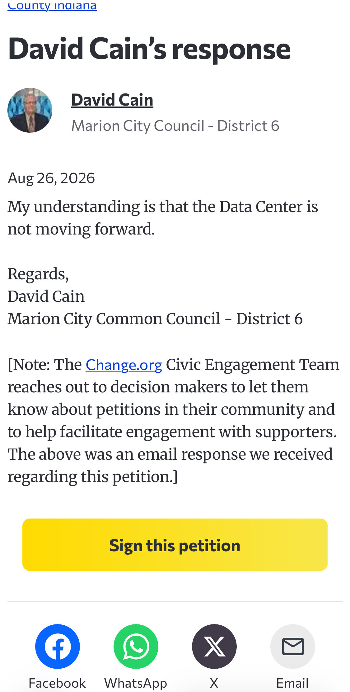
Page 1. ourweek.in/records/riverjump-case/cain-petition-response.pdf
The council president, from the chair. On September 1, at the council's first meeting after the mayor's statement, with people in the chamber holding signs against data centers, President Brian Cowgill spoke before taking up the consent agenda: "I see all the signs of no data centers… That's a done deal. It's not coming. It's over. The council has no control over that. It will never come to the council. It's got to come through the mayor. He stopped it." He is the second council member on the record and the first to say the project will not reach the council at all. It is his account of where the proposal stands. What the council could do if something did reach it is in the passage below.
Marion Common Council · September 1, 2026 · at 7:01
“That's a done deal. It's not coming. It's over. The council has no control over that. It will never come to the council. It's got to come through the mayor. He stopped it.”
The first time a Marion council member has addressed the data center from the dais. In seventy-five recorded council meetings since January 2024, the words had come up twice before: a member's aside about billion-dollar data centers during a software contract in August 2025, and the president cutting a resident's question back to the agenda in March 2026. Council President Brian Cowgill, before the consent agenda at the first meeting after the mayor's statement, to people in the chamber holding signs against data centers. It is his account of where the proposal stands; the passage on the statute below describes what the council could do if something reached it.
Scan to hear it said
Marion Common Council, September 1, 2026, at 6:44
https://youtu.be/JeZRzXaJfQE?t=404
What one official's no decides, and what it does not. The mayor's August 26 statement is a decision not to endorse. Nothing in it says the proposal is withdrawn, and the agreements his August 23 statement described — owners who have chosen to sell — are private contracts a mayor's position does not undo. By August 27 the position had widened — no data center development in Marion under his administration, he told the Chronicle-Tribune. A position is still not a withdrawal; the proposal is the developer's. What his position reaches, Indiana law states exactly. Every ordinance, order or resolution the common council passes goes to the mayor, who has ten days to sign or veto it; doing nothing counts as a veto; and a vetoed measure is dead unless the council passes it again, at its first meeting afterward, by a two-thirds vote — six of Marion's nine members. So a tax abatement, an economic development area, or an annexation inside Marion could still be enacted without the mayor, at six votes instead of five.
And none of the city's machinery governs the ground outside its limit. The corridor west of Marion's boundary is unincorporated Grant County, where the mayor holds no office and the county moratorium currently bars data center permits — until March 16, 2028, or until the county adopts the ordinance its subcommittee is drafting, whichever comes first. On that ground the question was never the mayor's. It belongs to the county's plan commission and its commissioners.
A 765-kilovolt line is being routed through the county, on a clock of its own. Indiana Michigan Power is planning about fifty miles of new 765-kilovolt transmission line between its Greentown substation in Howard County and the Sorenson substation in Huntington County. The company's fact sheet names more of Grant County than of any of the five other counties in the study area — the City of Marion, Gas City, and ten townships — and attributes the project to a mandate from the Midcontinent Independent System Operator, the regional grid operator for fifteen states, under its long-range plan.
Indiana Michigan Power · Project announced summer 2026 · page 1
“This project will also create opportunities for future growth and development.”
The study area, county by county.
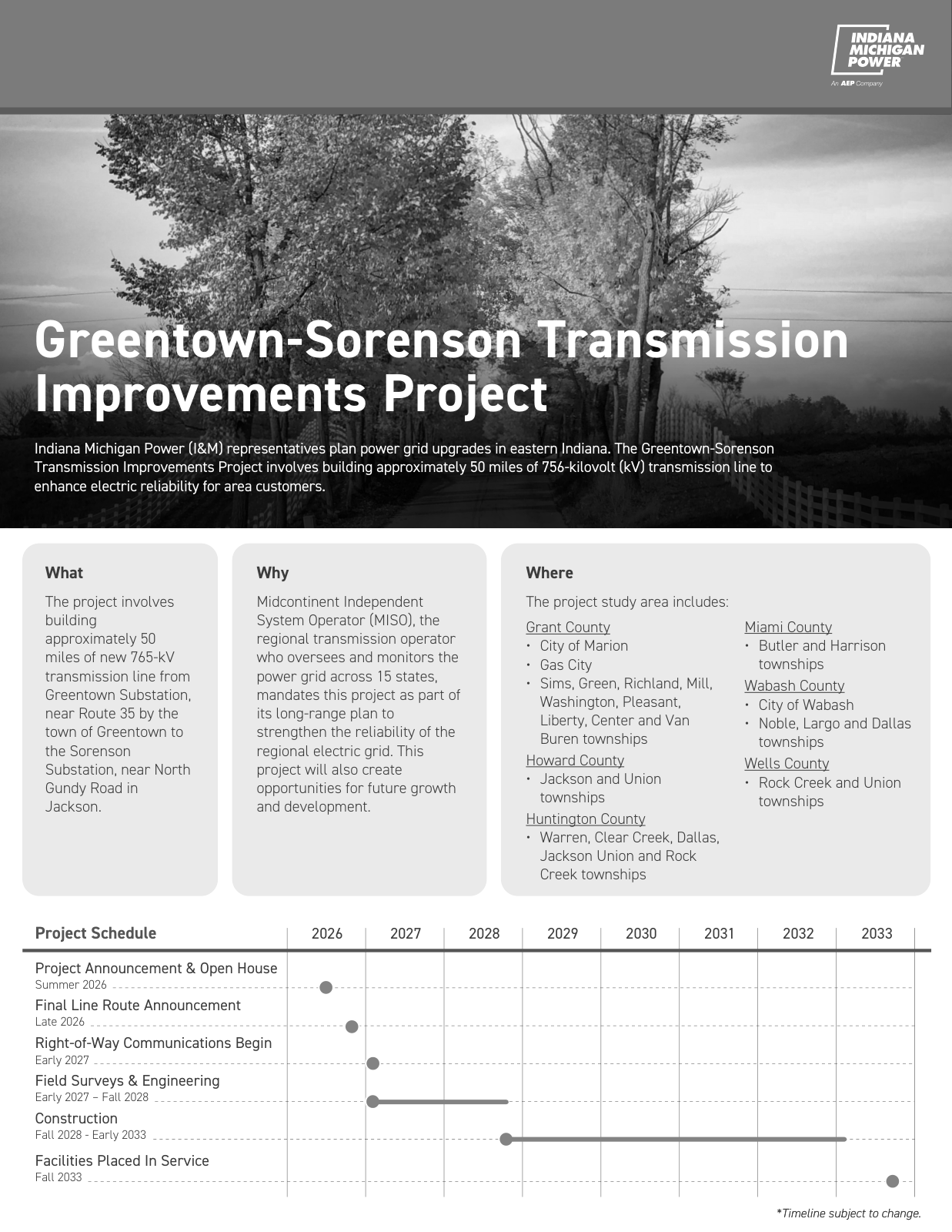
Page 1, the boxed lines. ourweek.in/records/data-centers/im-greentown-sorenson.pdf
The fact sheet never says "data center," and nothing in the county's record joins this line to Project Riverjump or to anything else on this page. It runs on a schedule of its own: a final route in late 2026, right-of-way conversations from early 2027, construction from fall 2028, and the line in service in fall 2033. The route has not been chosen, and the company is taking comment while it is.
The same talk puts a price on it, and has since before the mayor's post: about $150,000 an acre, across about 800 acres, from a few farmers. Nobody in government has said it. No document we have seen carries it. We have not verified it. That price would be about ten times what Purdue's June 2026 survey puts top-quality Indiana farmland at — $14,909 an acre — and five and a half times its $27,260 figure for land moving out of agriculture into residential, commercial or industrial use. Purdue cautions that these are statewide averages across differing soils and locations, not appraisals of any particular tract. It is also the kind of number that appears on a sales disclosure form the day a sale closes.
And the step that cannot happen in private. Indiana requires a fiscal body to adopt a declaratory resolution, publish notice and hold a public hearing before it can confirm a tax abatement. The sheet at the top of this page describes abatement periods and minimum payments during them; a real property abatement cannot be granted in Indiana without that process. So an abatement would require public notice, a public hearing and formal action by the designating body.
What that meeting would not necessarily produce is a name. Morgan County held its rezoning hearing in February 2025 and granted its abatement in May, both to a Delaware LLC, and the company behind them was not confirmed for another five months. A public hearing is where the public gets a formal chance to comment before final action. On the record from the counties above, it is not reliably where the public finds out who it is for.
Check it yourself
Two public databases will settle most of what is still open here, and neither costs anything.
The county's own property viewer carries recorded sales back to 2008 and is updated weekly. Search an address or a parcel number and it returns the owner of record, the transfer history and the assessed value — the same records this page was built from. It is at grantin.elevatemaps.io.
The state's sales disclosure search is where a buyer's name would appear. Indiana generally requires a sales disclosure form when property is conveyed for valuable consideration, and the Department of Local Government Finance publishes them searchable by buyer name — along with seller, parcel, price, property class and date. Anyone assembling ground at Exit 255, along Highway 18 in the corridor proposed for the west side economic development area, or around the old Dana plant would ordinarily produce one at closing, under the name of whatever entity is buying. Watch the buyer field for a name nobody here recognizes. That search covers 2021 forward; older years are on STATS Indiana.
There is a third, for a deal structured so it never shows up as a sale at all. A lease longer than three years is recorded with the county recorder, in the Miscellaneous Record; one not recorded within forty-five days of signing is void against a later good-faith buyer. A ground lease for a development of this size can run for decades.
That is the whole of it — everything we have been able to find in the public record about data centers in Grant County. Everything above opens onto the source it came from.
If you have a fact check on something we covered, or a tip about something we did not, email us at hello@ourweek.in.
The NDA Question
Four answers to that question are now on the record — the plan commission's, Commissioner Poling's, a council member's and Mayor Morrell's — and every one is no. The mayor's answer grew on August 27: not himself, and to his knowledge no City of Marion staff member — and, in his words, "I cannot speak to whether individuals or officials outside of the City of Marion, including those at the county level or within other organizations, entered into NDAs." No record answers who signed the agreement the county's consultant mentioned in July 2025, or whether anyone holding office outside the city has signed one.
We are putting the same question to all 178 — every state and local official on the Grant County ballot, and our three members of Congress — and publishing every answer as it arrives.
Are you an elected official in Grant County? Say whether you have signed a non-disclosure or confidentiality agreement about data center development. It takes one click and nothing else: no company, no project, no terms. I would rather not say is on the form and is printed exactly as given.
Answer the question: https://ourweek.in/nda
The documents behind this page
| Document | Date | What it carries |
|---|---|---|
| Exit 255 Economic Development Feasibility Study (BCS Management, for the county commissioners) | Sept 20, 2025 | "The Data Center Dilemma," pp. 24–25: soft-pedal the idea in all public documents, secure land options before any public announcement. Also the 1-million-gallon-a-day aquifer well field and the utility's hyperscale load forecast. |
| Grant County Comprehensive Plan | Adopted Sept 2, 2025 | More than 75% of first public meeting attendees said agricultural land should be preserved from large-scale development. |
| Ordinance 4-2026, the data center moratorium | Signed March 16, 2026 | Through March 16, 2028, or until a data center zoning amendment is adopted, whichever comes first. Improvement location permits, unincorporated county only. |
| Recore Digital email to the Area Plan Commission | June 15, 2026 | "Currently acquiring an actively operating crypto mining site," seeking pilot-project treatment; the director's reply the next day. |
| Grant County area zoning ordinance | current | Section 153.99 penalties, $2,500 a day, the enforcement the draft points back to. |
| Commissioners' conflict-of-interest filings, 2025 and 2026 | Apr 7, 2025; Jan 5, 2026 | Accepted in open session; the minutes do not state what they disclose. |
| Bit Origin Ltd annual reports (Forms 20-F) | 2023, 2024 | A hosting customer at the Marion site, not its operator: the filing names Your Choice 4 CA, Inc. as the host. 1,490 miners moved there from Georgia in January 2023; Bit Origin ceased its Marion operation in September 2023 and moved its miners to Wyoming. |
| Presidential order on MineOne Partners | May 13, 2024 | Divestment of the Wyoming site the Marion miners moved to, on Chinese-ownership grounds near an Air Force base. |
| Census small-area income and poverty estimates, 2024 | Released Jan 2026 | Grant County last of 92 Indiana counties in median household income. |
| Purdue farmland value survey | June 2026 | Top-quality Indiana farmland $14,909 an acre; land moving out of agriculture into other uses $27,260. |
| Grant County parcel and tax records, three study areas | Pulled Aug 20, 2026 | Owner of record, assessed use and transfer dates for 1,753 parcels across the I-69/SR 26 interchange, the SR 18 corridor west of Marion, and the Miller Avenue quadrant. |
Every row here is a public record. Where a document is not posted online, the office that holds it is named so it can be requested.
Sources and methods
A standing page, updated as the record grows. Written from three bodies of evidence, kept distinct in the text: (1) the county's own recordings and minutes — 20 recorded meetings are cited and playable above, and the full 4,503-document minutes corpus (1997–2026) was searched for every name and term that comes up in this subject; (2) documents linked in the table above, most of them posted by the county itself; (3) named outside reporting and primary sources, linked where cited. Quotations located via automatic captions were checked against the recordings' context but can still garble names — the video, not this page, is the record. Where a claim circulating in the county has no public support, this page says so rather than repeating it. This page rules on sourcing, not on anyone's motives.
- Channel Grant County Government meeting recordings — https://www.youtube.com/@grantcountygovernment8878 (Timestamps were located with automatic captions, which garble proper nouns. Watch the clip before repeating a name, a number or a quotation.)
- Channel City of Marion Common Council recordings — https://www.youtube.com/@cityofmarionindiana
- Document Exit 255 Economic Development Feasibility Study, BCS Management for the Grant County Commissioners — https://www.in.gov/counties/grant/files/Exit255FeasibilityStudy_GrantCounty_FinalReport_2025compressed.pdf (Dated September 20, 2025. The "soft-pedal" and land-option recommendations are on pages 24 and 25.)
- Document Grant County Comprehensive Plan, adopted September 2, 2025 — https://secure.in.gov/counties/grant/files/Grantco_CompPlan_9.02.25.pdf
- Dataset Grant County minutes and agendas, 1997-2026 (4,503 documents) (Published by the county boards through their own minutes systems; searched in full for every name and term that comes up in this subject.)
- Dataset Indiana statewide parcel layer and Grant County tax records — https://gisdata.in.gov/ (Acreage is computed from parcel geometry and is approximate; the county deeded acreage governs. Owner records resolved for 1,718 of 1,753 parcels; the 35 that did not resolve total 78 acres, none of them larger than ten, and the state layer carries no class code for any of them.)
- Article Chronicle-Tribune coverage of the moratorium, the Recore Digital inquiry, and the Beckwith town hall — https://www.chronicle-tribune.com/ (The paper has covered every public beat of this story; several articles are paywalled.)
- Records request Not yet obtained: the unredacted county file on Recore Digital (Offered under the Access to Public Records Act and not yet requested. This page does not rely on it.)
- Document Grant County commissioners' conflict-of-interest filings, Indiana State Board of Accounts — https://gateway.ifionline.org/sboa_coi/ (The 2026 statements for Shane Middlesworth and Chuck Poling, each stamped filed January 5, 2026 by the Grant County circuit court clerk, are free public PDFs in this database. No records request is needed.)
- Document Indiana DNR Division of Water, Water Resource Assessment 2003-7, ground-water availability — https://www.in.gov/dnr/water/files/12-41.pdf (The source of the "only marginal at best" line, which describes the Lafayette (Teays) valley from La Fontaine to Richvalley in Wabash County — not the Marion well fields and not the Exit 255 site. The feasibility study relies instead on the DNR's 2012 Grant County aquifer study.)
- Article Chronicle-Tribune, "Mayor walks away from proposed data center project" (Laura Mack, Aug. 27, 2026) — https://www.chronicle-tribune.com/news/mayor-walks-away-from-proposed-data-center-project/article_a3f15237-10b5-5a1c-a5b4-84234624e357.html (The mayor's Aug. 24 and Aug. 27 interviews, including his naming of Meta. Subscription may be required to read in full.)